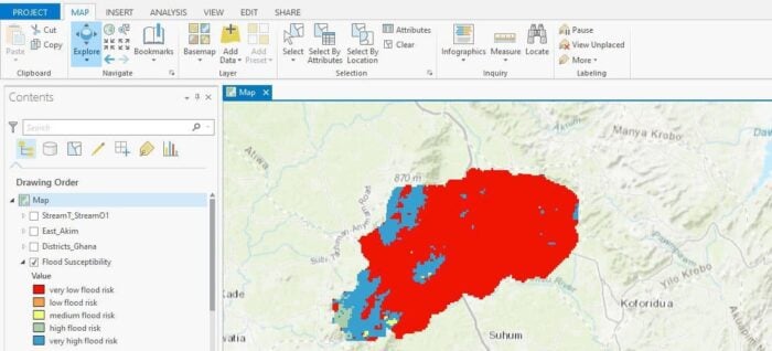
How to Use ArcGIS Pro to Map Flood Susceptibility
This tutorial makes use of spatial data science and remote sensing techniques to assess the susceptibility of floods using ArcGIS Pro.
Copy and paste this URL into your WordPress site to embed
Copy and paste this code into your site to embed