
Tracing Medieval Rewilding Through Italy’s Ancient Oaks
A study of ancient oak trees reveals how changes in human land use allowed forests to expand across parts of Italy during the medieval period.

Spatial Analysis
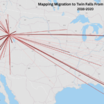
How to Create a Radial Flow Map Using QGIS


Hydrology
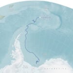
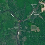
Rivers that Flow Backwards
Geography Basics
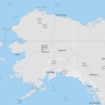
Northernmost Point in the United States
Spatial Analysis
How to Create a Radial Flow Map Using QGIS
Cultural Geography
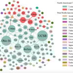
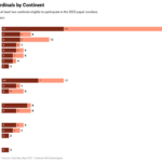
Map and Chart of Cardinals and the 2025 Papal Conclave
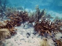
Florida’s Primary Reef-Building Corals are ‘Functionally Extinct’
A 2023 heatwave killed nearly all of Florida’s main reef-building corals, leaving the reef functionally extinct.
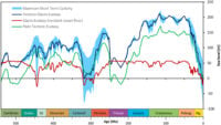
Mapping Short-term Sea Level Changes Over 540 Million Years
Researchers mapped 540 million years of sea level change, showing major short-term shifts during ice ages driven by Earth’s orbital cycles.
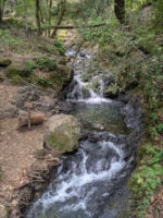
Water Can Take Years to Seep out of Mountains
Groundwater stored over many years is a significant contributor to streamflow in Western United States mountains according to a published study.

Study Models How the Behavior of Waves Affects Blue Carbon Storage
Bubbles created by the movement of waves can influence how much carbon dioxide is absorbed by the ocean.
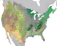
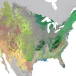
High Resolution Ecosystem Map of the Contiguous United States and Adjacent Areas
NatureServe has developed an updated 30-meter hexagon map of regional ecosystems in the contiguous United States and adjacent areas.
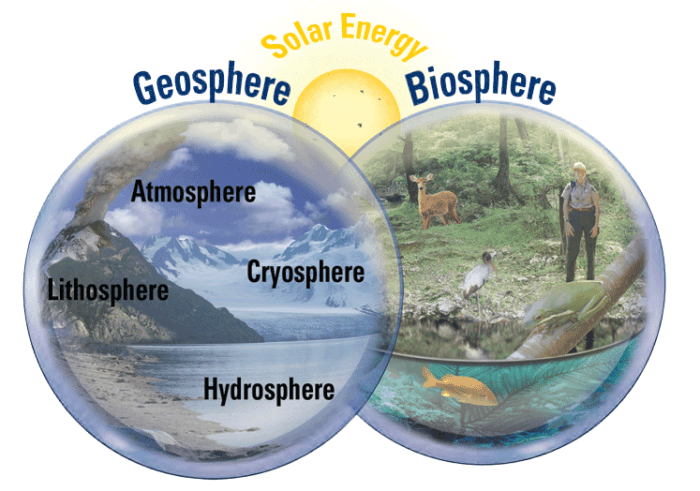
What are the Earth System’s Four Spheres?
The systems of the earth can be divided into two main areas: geosphere and biosphere.

The Recreational Value of Nature and Wildlife
Measuring the economic benefits of wildlife and outdoor areas supports conservation with tools like the NPS Visitor Spending Effects.