
Physical Geography
Physical geography focuses on geography as an Earth science (and is sometimes called Earth System Science).
Physical geography is a branch of geography that focuses on the study of the natural features and processes of the Earth’s surface. It includes the examination of landforms, climate, vegetation, soils, and water resources. Physical geographers use a range of scientific methods and tools to analyze and understand the complex interactions between the Earth’s physical systems.
Learn about the different branches of geography that fall under the physical geography category: climatology, geomorphology, biogeography, and more.

Alaska’s Coastline is Longer Than All the Other 49 States Combined
Alaska has the longest U.S. coastline, but its length varies depending on how closely the coast and shoreline are measured.

Geography Facts about the World’s Continents
How many continents are there? Explore the four to seven continent models and compare the world's continents by size, population, and geography.

Highest Point in Every U.S. State
Every U.S. state's highest point, from Denali to Britton Hill, with elevations, maps, and geographic facts.

Why Do Squirrels Lie Flat?
Splooting helps squirrels lie flat to regulate body temperature, avoid predators, sunbathe, and rest. Explore the science behind this behavior.

Greatest Concentration of Breeding Bald Eagles in the Contiguous United States
The San Juan Islands support one of the highest densities of breeding bald eagles in the contiguous United States. Here's why.
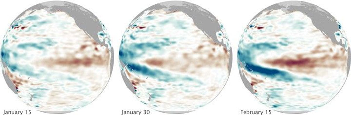
How Remote Sensing Helps NOAA Monitor El Niño
Learn how satellites measure ocean temperatures, sea surface height, and other indicators used to monitor El Niño.
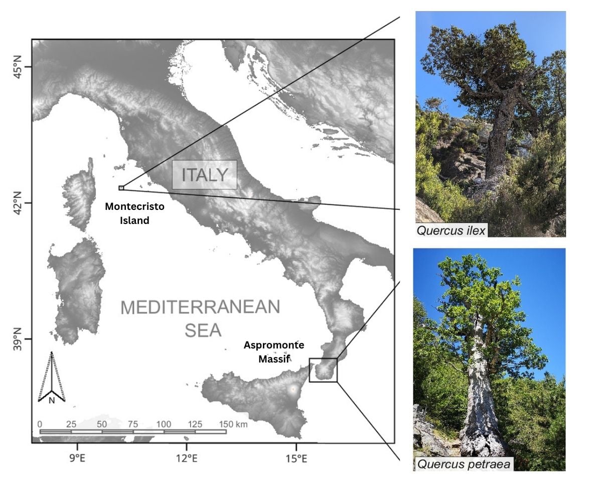
Tracing Medieval Rewilding Through Italy’s Ancient Oaks
A study of ancient oak trees reveals how changes in human land use allowed forests to expand across parts of Italy during the medieval period.
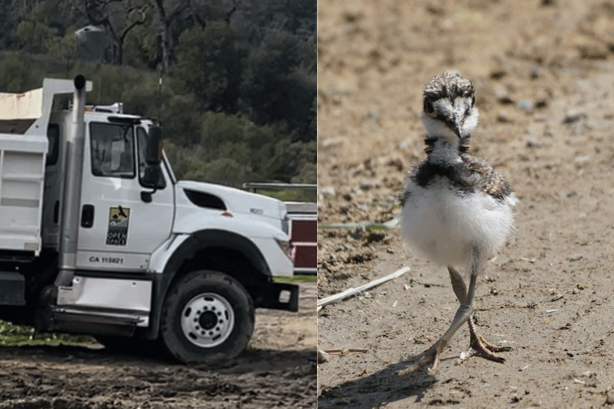
Midpen Open Space and the Harm of Repeat Disturbance
At Bear Creek Redwoods Open Space Preserve, repeated nesting season projects by Midpeninsula Regional Open Space District are altering habitat used by migratory birds.

What are Those Clumps in Trees?
Discover why squirrels build dreys, the leafy nests hidden high in trees, and why they become easier to spot after autumn leaves fall.
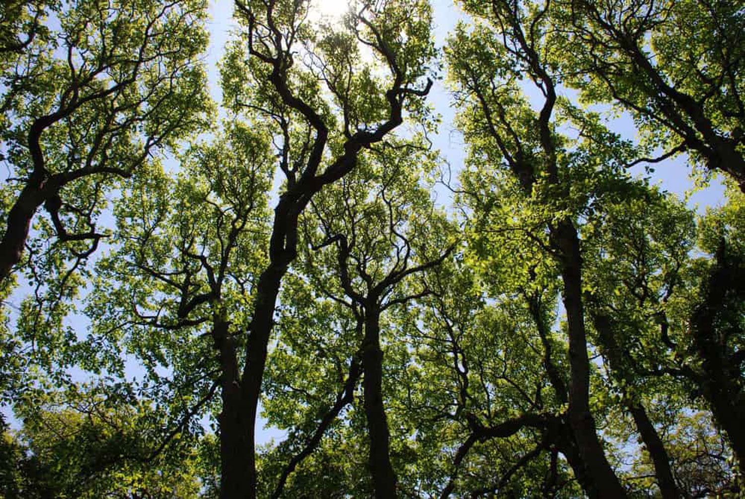
Crown Shyness: When Trees Need Personal Space
Why don't tree branches touch? Crown shyness is the natural phenomenon that creates the gaps between neighboring tree canopies.

Florida’s Primary Reef-Building Corals are ‘Functionally Extinct’
A 2023 heatwave killed nearly all of Florida’s main reef-building corals, leaving the reef functionally extinct.
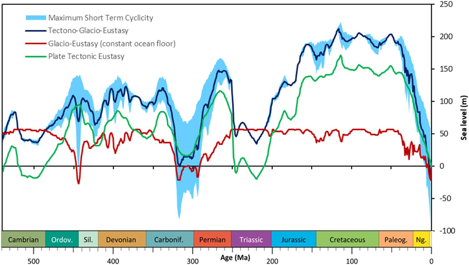
Mapping Short-term Sea Level Changes Over 540 Million Years
Researchers mapped 540 million years of sea level change, showing major short-term shifts during ice ages driven by Earth's orbital cycles.

Water Can Take Years to Seep out of Mountains
Groundwater stored over many years is a significant contributor to streamflow in Western United States mountains according to a published study.
Study Models How the Behavior of Waves Affects Blue Carbon Storage
Bubbles created by the movement of waves can influence how much carbon dioxide is absorbed by the ocean.
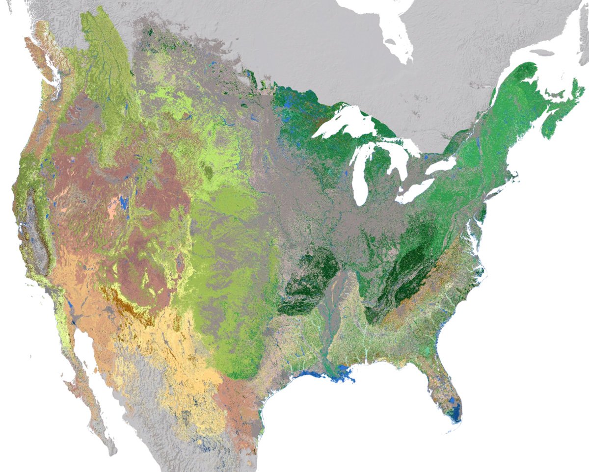
High Resolution Ecosystem Map of the Contiguous United States and Adjacent Areas
NatureServe has developed an updated 30-meter hexagon map of regional ecosystems in the contiguous United States and adjacent areas.
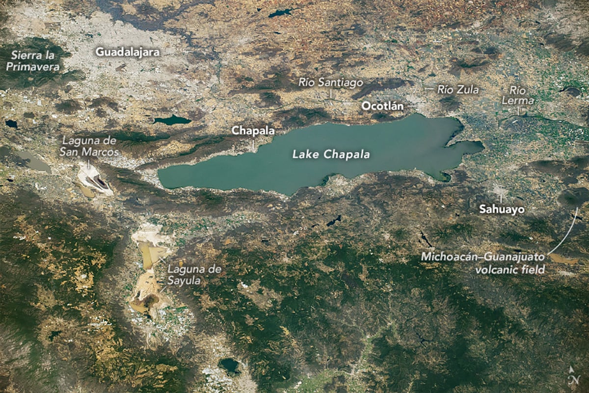
Lake Chapala: A Tectonic Lake Formed Where Three Grabens Meet
The geology of Lake Chapala reveals how faulting and volcanic activity shaped Mexico's largest freshwater lake.

Rivers that Flow Backwards
Read about how the Amazon once flowed east to west and how the strength of Hurricane Isaac once change the course of the Mississippi river.
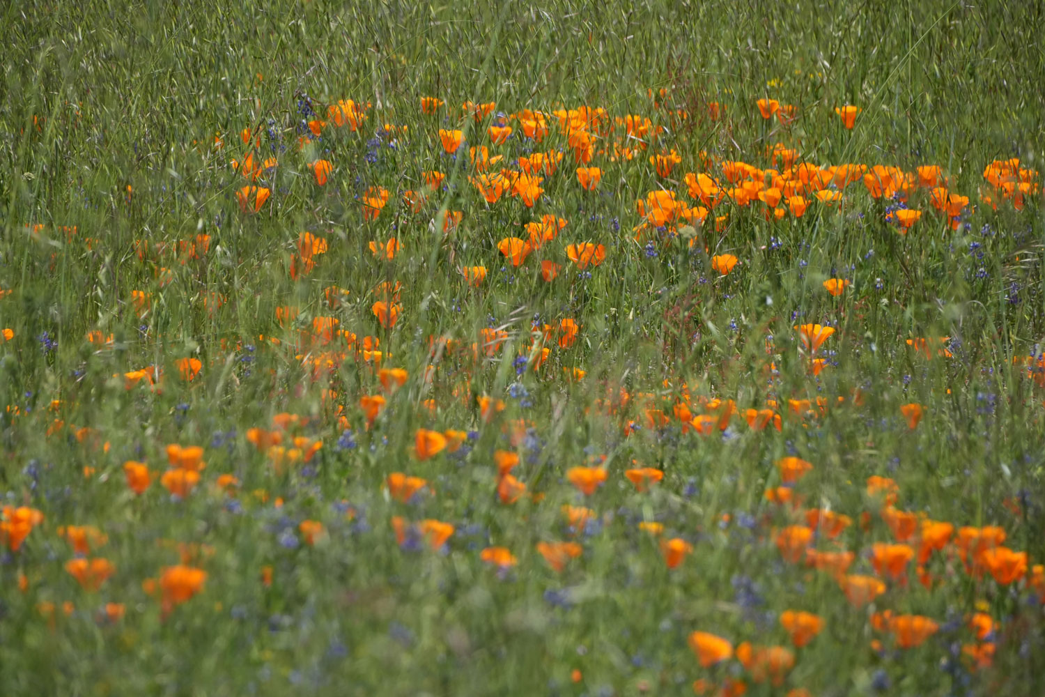
Where Superblooms Occur in the United States
Discover where superblooms occur across the United States, from California's deserts to spectacular spring wildflower displays across the West.

World’s Biggest Iceberg
The largest iceberg in the world is A-23A, with an area of about 1,240 square miles.

Satellite Imagery of Clouds
Listed here are different clouds formations as seen on satellite imagery.

Water on Earth
Earth holds trillions of tons of water, mostly in oceans. Only 2.5% is freshwater, primarily found in glaciers, groundwater, lakes, and rivers.

How Much Forest Covers the Earth Depends on the Definition
Forest cover estimates vary because there is no universal definition of a forest. Learn how canopy cover, tree height, and area thresholds affect global forest maps.

Glacial Flour Makes Some Lakes Turquoise
Glacial flour, the fine dust created as glaciers move over land, turns lakes a turquoise color by reflecting blue and green light.

Hydroclimate Whiplash: the Impact on California Wildfires
Rapid shifts between extremely dry and unusually wet conditions are reshaping California’s fire landscape by increasing vegetation growth, drying fuels, and contributing to more intense wildfires.

What Are Glacier Grounding Lines?
Grounding lines mark where glaciers begin floating, making them one of the most important indicators of ice sheet stability and sea-level rise.

Increased Light Pollution in the Arctic
Satellite data reveals growing nighttime light levels across the Arctic, linked to expanding oil, gas, shipping, and infrastructure activity.