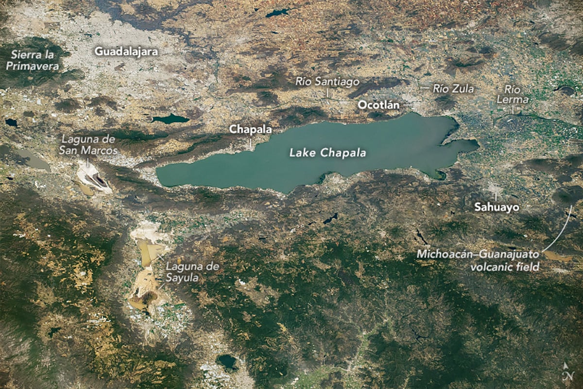
Located on the border of Jalisco and Michoacán, Lake Chapala is Mexico’s largest freshwater lake. The shallow lake is roughly 420 square miles (1,110 square kilometers) in size.
Lake Chapala lies within the Trans-Mexican Volcanic Belt (TMVB), a 1,000-kilometer-long arc created by subduction of the Cocos Plate beneath North America that runs from the Gulf of Mexico to the Pacific Ocean. Nearby volcanic features include the Sierra la Primavera caldera to the west and the Michoacán–Guanajuato volcanic field to the east. The active Volcán de Colima is found southwest from the lake.
Lake Chapala is at the intersection of three grabens
Lake Chapala owes its formation due to tectonic movement in the area. A graben is a block of depressed crust caused by the movement of the surface of the Earth along faults. Lake Chapala occupies the lowest part of the Chapala graben, but two other rift valleys, the Tepic-Zacoalco and Colima grabens, meet the Chapala system just west of the lake, to form what geologists call the Jalisco triple junction.
Both the Río Lerma and Río Zula feed into Lake Chapala. Water flows from Lake Chapala via Río Santiago to eventually empty into the Pacific Ocean.