
Geography Realm offers printable that you can purchase for immediate access via the GeographyFun Etsy shop. GeographyFun is a growing digital product shop featuring crosswords and word searches for educators, students, and geography enthusiasts who love exploring the world through words.
🌐 Educational Benefits of Geography Puzzles:
Enhances Geographical Knowledge: Dive into the world of geography, learning about diverse places and cultures in an interactive manner.
Boosts Word and Cognitive Skills: Apart from geographical knowledge, these puzzles are great for improving vocabulary, spelling, and cognitive abilities like problem-solving and memory.
Versatile Teaching Tool: Ideal for classroom activities, homeschooling curriculums, or as a supplement to traditional geography textbooks.
Engages Diverse Learning Styles: Appeals to visual and linguistic learners, offering a dynamic approach to geography education.
Shop our Etsy Shop geography printables
These geography printables are available for purchase from our Etsy Shop, GeographyFun.

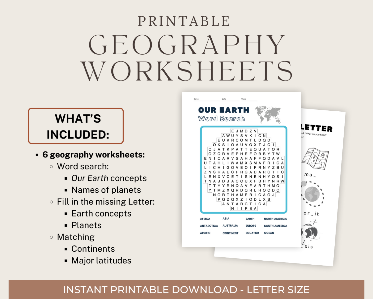
Basic Geography Worksheets: Missing letter, word search, and matching
Help early learners practice key geography concepts with this printable set of worksheets. The worksheet packet (PDF) covers spelling and identification activities for the planets of the solar system, lines of latitude (parallels), and basic Earth features.
Level: K-3 grades

Physical Geography Word Search Puzzles
Have fun learning physical geography terminology with these five geography themed word search puzzles. The packet of one PDF contains ten pages: five geography word search puzzles and answer sheets focused around physical geography themes.
Level: High school and college students.

New England Geography
This educational set of outline maps, word search, and crossword puzzle helps children learn about the states and capitals of New England.
Level: Elementary and Middle School students.
Geography Crossword puzzles

Geography of California Crossword
Combine learning and fun with this 10-clue crossword puzzle featuring geography facts about California.
Level: Elementary students (3rd – 5th grade).


Biodiversity Crossword
Combine learning and fun with this ecology and biodiversity crossword puzzle.
Level: high school and college students.

Geography Puzzle and Map Pack
Free outline maps
Free outline maps to print and use. Use outline maps as an educational tool for teachers, students, and parents. Each map is in PDF format and is fitted to an 8 1/2″ x 11″ (letter sized) sheet of paper.
Print out base maps to learn geography, take a geography test, or create educational projects. Maps are available cover the United States and maps of the world.
Free outline maps of the United States:
Each map is letter-sized (8.5″ x 11″) covering the United States of America. Click on each link to access the map in PDF format:
- United States with states labeled
- United States with state abbreviations labeled
- United States unlabeled
- United States unlabeled with capitals marked
- United States unlabeled with counties
Outline Maps By State
Free outline maps of the world, 2010*:
Each map of the world is letter-sized (8.5″ x 11″). Click on each link to access the map in PDF format:
The World (Robinson projection) – This projection shows the entire world as a relatively flat image. The projection is neither equal-area nor conformal. Distortion is greatest at the poles and becomes quickly moderate moving towards the equator. This projection was used by National Geographic between 1988 and 1998. Rand McNally has used this projection since 1961.
The World (Winkel tripel projection) – A modified azimuthal map projection this projection has been used by National Geographic since 1998 for maps showing the entire world.
The World (Plate carrée projection) – This projection is known by many names (equirectangular projection (also called the equidistant cylindrical projection, geographic projection, carte parallelogrammatique projection or CPP) and is neither equal area nor conformal. The globe is convert into a Cartesian grid with the poles represented as lines across the top and bottom of the map.
* Note: Maps do not include countries formed after 2011 such as South Sudan.
Free outline map of Europe
Free Outline map of Central and South America
Free Coloring Maps
These printable PDF maps allow students a way to learn about the countries found within Europe, South and Central America, and Africa. Outline maps are great educational tools to help students learn about geography.
There is also a PDF coloring map covering the fifty states in the United States. Lastly, there is a coloring map of the seven continents.
Note: all maps were created in 2013 so newer and recently renamed countries will not be listed.
Related Lessons and Resources
- Continents and Population Density
- Historical Coloring Maps – Printable PDFs you can color of historical maps dating from the 14th and 15th centuries.