The upper northeast region of the United States is known as New England. New England is characterized by a diverse and captivating geography. One of the most prominent features of New England is the jagged coastline, stretching along the Atlantic Ocean, which includes iconic landmarks like Cape Cod and the rocky shores of Maine.
Inland, the New England landscape is famous for its forests, rolling hills, and fertile valleys, offering a picturesque backdrop for the historic towns and farmland in this area. 90% of Maine, one of the states in New England, is covered by forests — this is the highest percent of any U.S. state with an estimated 17,532,518 acres of forest land.
New England is also known for its rugged terrain, shaped by glacial activity during the last ice age, resulting in numerous lakes, rivers, and small ponds.

The region experiences distinct seasons, with the area’s fall foliage attracting visitors from far and wide. The changing color of the leaves in New England is so vibrant that it can be seen on satellite imagery.
New England’s geographical boundaries are defined by Canada to the north, the Atlantic Ocean to the east, Long Island Sound to the south, and the state of New York to the west.
What states are in New England?
New England is made up of six states.
The six states that are part of New England are:
- Connecticut
- Maine
- Massachusetts
- New Hampshire
- Rhode Island
- Vermont

Related from the Geography Realm shop at Etsy: New England Geography Printables: Outline maps, word search, and crossword puzzle
Area of New England
The total area of New England is 71,987 square miles (186,447 square kilometers).
The largest state in New England is Maine with a total area of 35,380 square miles (91,633 square kilometers).
The smallest state in New England is Rhode Island with 1,545 square miles ( 4,0001 square kilometers).
The total area of New England broken down by state is:
| State | Square Miles | Square Kilometers |
| Connecticut | 5,543 | 14,357 |
| Maine | 35,380 | 91,633 |
| Massachusetts | 10,554 | 27,336 |
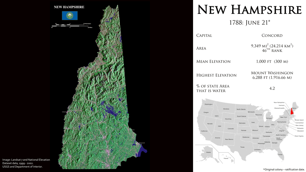
| New Hampshire | 9,349 | 24,214 |
| Rhode Island | 1,545 | 4,001 |
| Vermont | 9,616 | 24,906 |
| Total | 71,987 | 186,447 |
Map of the New England States

Connecticut
- Nickname: Constitution State
- Capital: Hartford
- Highest Elevation: 2,379 ft (725 m)
- Population (2020): 3,605,944
Living Symbols of Connecticut
- State animal: sperm whale
- State flower: mountain laurel
- State bird: American robin

Maine
- Nickname: Pine Tree State
- Capital: Augusta
- Highest Elevation: 5,270 ft (1,606.4 m)
- Population (2020): 1,362,359
Living Symbols of Maine
- Bird: Black-capped chickadee
- Cat: Maine Coon
- Crustacean: Lobster
- Fish: Landlocked Atlantic salmon
- Flower: White pine cone
- Insect: Honey bee
- Mammal: Moose
- Tree: Eastern white pine

Massachusetts
Nickname: Bay State
Capital: Boston
Highest Elevation: 3,489 ft (1,063.4 m)
Population (2020): 7,033,469
Living symbols of Massachusetts
- Bird: Black-capped chickadee, wild turkey
- Fish: Cod
- Flower: Mayflower
- Insect: Ladybug
- Mammal: Right whale, Morgan horse, Tabby cat, Boston Terrier
- Reptile: Garter snake
- Tree: American elm

New Hampshire
Nickname: Granite State
Capital: Concord
Highest Elevation: 9,349 sq mi (24,214 km2)
Population (2020): 1,377,529
Living symbols of New Hampshire
- Amphibian: Red-spotted newt
- Bird: Purple finch
- Butterfly: Karner Blue
- Dog breed: Chinook
- Fish: Freshwater – Brook trout
Saltwater – Striped bass - Flower: Purple lilac
- Insect: Ladybug
- Mammal: White-tailed deer
- Tree: White birch

Rhode Island
Nickname: Ocean State
Capital: Providence
Highest Elevation: 812 ft (247 m)
Population (2020): 1,098,163
Living symbols of Rhode Island
- Bird: Rhode Island Red chicken
- Fish: Striped bass
- Flower: Violet
- Insect: American burying beetle
- Mammal: Morgan horse
- Reptile: Painted turtle
- Tree: Red Maple
Learn more: Geography Facts: Rhode Island

Vermont
Nickname: Green Mountain State
Capital: Montpelier
Highest Elevation: 4,395 ft (1,340 m)
Population (2020): 643,503
Living symbols of Vermont
- Amphibian: Northern leopard frog
- Bird: Hermit thrush
- Fish: Brook trout and Walleye
- Flower: Red clover
- Insect: Western honey bee
- Mammal: Morgan horse
- Reptile: Painted turtle
- Tree: Sugar maple

