
The Atlantic Ocean, named after the Greek god Atlas, is the second-largest ocean in the world. The Pacific Ocean is the largest ocean in the world.
How Large is the Atlantic Ocean?
The Atlantic Ocean has an area of about 106,460,000 square kilometers (41,105,000 square miles). The Atlantic Ocean covers 20% of the Earth’s surface.
Where is the Atlantic Ocean Located?
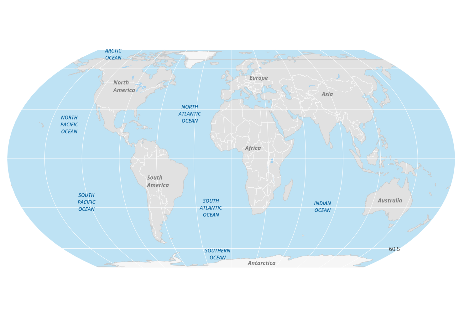
The Atlantic Ocean is located between the Americas to the west and Europe and Africa to the east. The ocean extends from the Arctic Ocean in the north to the Southern Ocean in the south.
The cardinal boundaries of the Atlantic Ocean:
- To the west: North and South America
- To the east: Europe and Africa
- To the north: Arctic Ocean
- To the south: Southern Ocean
Basins of the Atlantic Ocean
The Atlantic Ocean is divided into two basins: the North Atlantic and the South Atlantic. The North Atlantic is the larger of the two basins with an area of North Atlantic: 41,490,000 square kilometers (16,020,000 square miles).

Lowest Point in the Atlantic Ocean
The lowest point in the Atlantic Ocean is the Puerto Rico Trench, located at a depth of 8,376 meters (27,480 feet). This trench is located on the boundary between the Caribbean Sea and the Atlantic Ocean.
Countries with a coastline along the Atlantic Ocean
List of countries by continent that have a coastline along the Atlantic Ocean:
North America
- Canada
- United States
- Mexico
- Bahamas
- Cuba
- Haiti
- Dominican Republic
- Puerto Rico (U.S. territory)
- Jamaica
- Belize
- Guatemala
- Honduras
- Nicaragua
- Costa Rica
- Panama
Greenland, an autonomous territory within the Kingdom of Denmark, has a coastline along the Atlantic Ocean. Although it is geographically part of North America, it is often associated with Europe due to its political ties with Denmark.
South America
- Colombia
- Venezuela
- Guyana
- Suriname
- French Guiana (France)
- Brazil
- Uruguay
- Argentina
Europe
- Iceland
- Ireland
- United Kingdom
- Portugal
- Spain
- France
- Belgium
- Netherlands
- Germany
- Denmark
- Norway
Africa
- Morocco
- Western Sahara (disputed territory, claimed by Morocco)
- Mauritania
- Senegal
- The Gambia
- Guinea-Bissau
- Guinea
- Sierra Leone
- Liberia
- Ivory Coast
- Ghana
- Togo
- Benin
- Nigeria
- Cameroon
- Equatorial Guinea
- Gabon
- Republic of the Congo
- Democratic Republic of the Congo
- Angola
- Namibia
- South Africa
Asia
- Turkey (European and Asian portions both have coastlines)
- Georgia
U.S. States with an Atlantic Ocean coastline
The following states and territories of the United States have Atlantic coastlines: Delaware, Florida, Maine, North Carolina, Maryland, New Jersey, New York, South Carolina, Virginia, and Puerto Rico.

Hurricane season in the Atlantic Ocean
Hurricanes are storms that occur in the Atlantic Ocean and northeastern Pacific Ocean (typhoons occur in the northwestern Pacific Ocean and cyclones happen in the South Pacific Ocean or Indian Ocean).
Hurricanes mostly form in the Atlantic Ocean between June and November each year.

The saltiest ocean
Of the major oceans, the Atlantic Ocean is the saltiest on average.
Sea turtle species in the Atlantic Ocean
The green, hawksbill, kemp’s ridley, leatherback, loggerhead, and olive ridley are six of the world’s seven sea turtle species that can be found in the Atlantic Ocean.

Sargasso Sea is surrounded by the Atlantic Ocean
The Sargasso Sea is located in the middle of the Northern Atlantic Subtropical Gyre (a gyre is a large system of rotating ocean currents) near the Bermuda Islands in the Atlantic Ocean. This sea is the only sea in the world without a coast.
