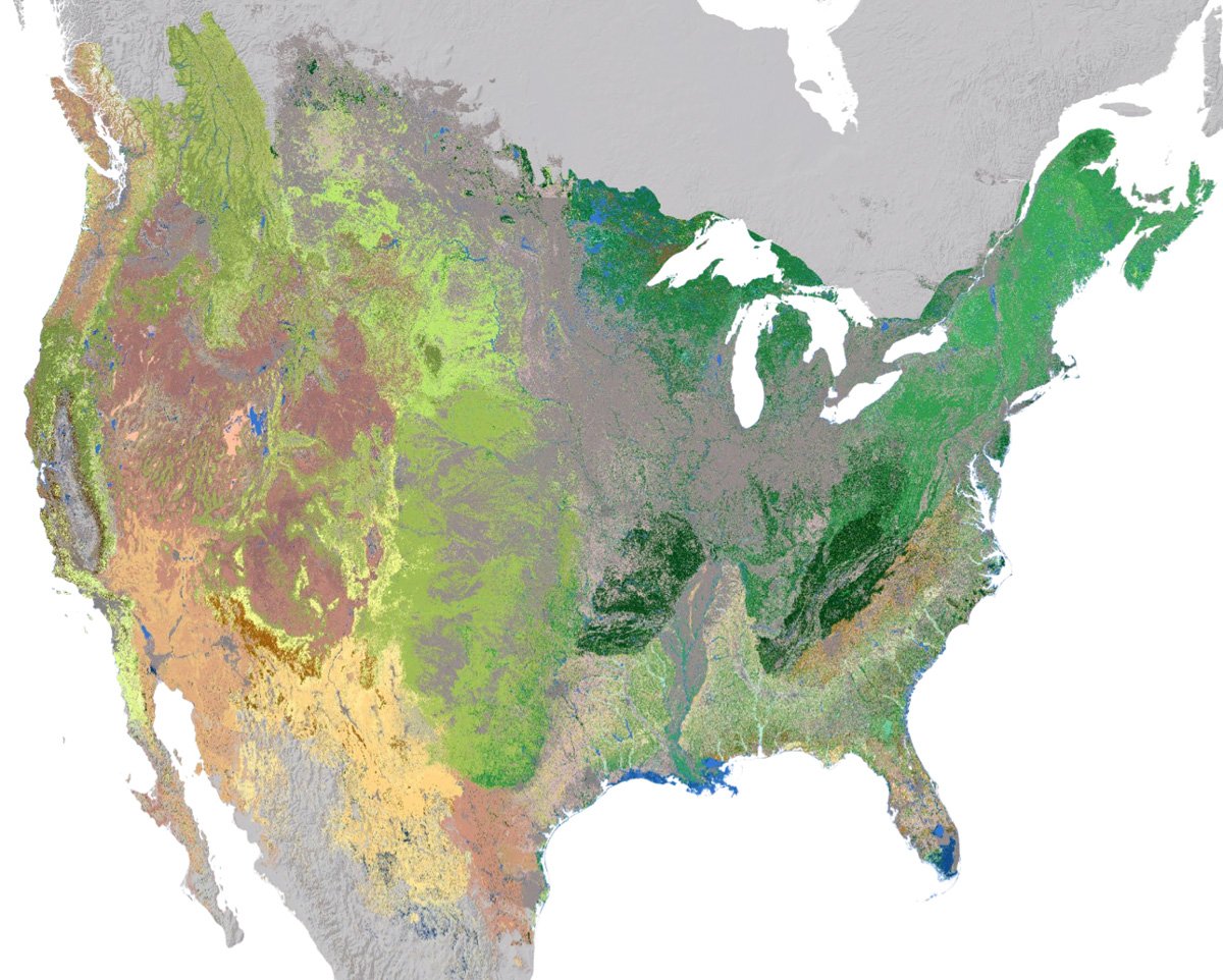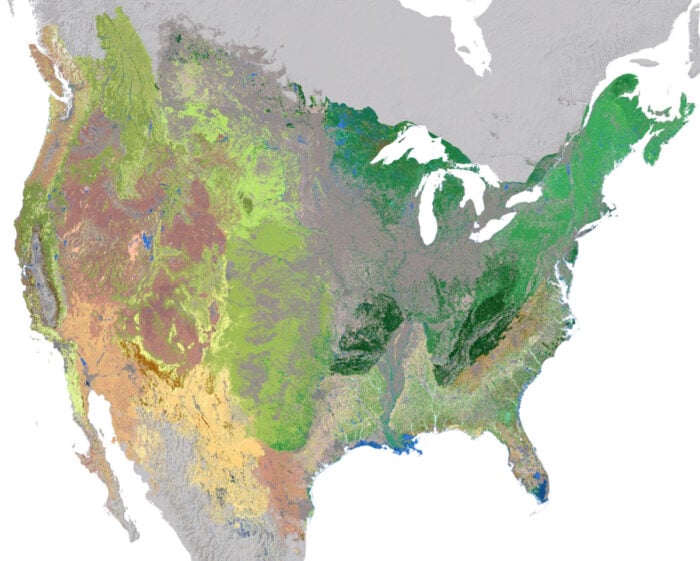
NatureServe, a nonprofit organization that helps to develop biodiversity data for North America in order to promote conservation efforts, has released a 30-meter resolution terrestrial ecosystem map for the contiguous United States and adjacent areas in Canada and Mexico.
The geospatial database features mid-level ecosystem clarifications for 321 US National Vegetation Classifications (USNVC) and nine other land cover and anthropogenic land use groups. Vegetation is grouped based on shared ecological traits, including climate tolerance, soil requirements, and dominant species.
NatureServe’s U.S. regional ecosystem map builds off of 2022 LANDFIRE Existing Vegetation Types (EVTs) which the nonprofit also developed. The end product is a 30-meter resolution hexagon map developed based on the input from a network of ecologists. These ecologists made suggestions to either keep the ecosystem attribution of each pixel as is, change to a different ecosystem classification, or designate as unknown.
More about the regional ecosystem map of the contiguous United States and adjacent areas
- More information about the data can be found in this document: Map of Ecosystems of North America, V1.0.
- Ecosystems of North America, V1.0 is an imagery dataset that can currently be accessed as a layer package.