
Biogeography
Biogeography is the study of the geographical distribution of plants and animals.

Why Do Squirrels Lie Flat?
Splooting helps squirrels lie flat to regulate body temperature, avoid predators, sunbathe, and rest. Explore the science behind this behavior.

Greatest Concentration of Breeding Bald Eagles in the Contiguous United States
The San Juan Islands support one of the highest densities of breeding bald eagles in the contiguous United States. Here's why.
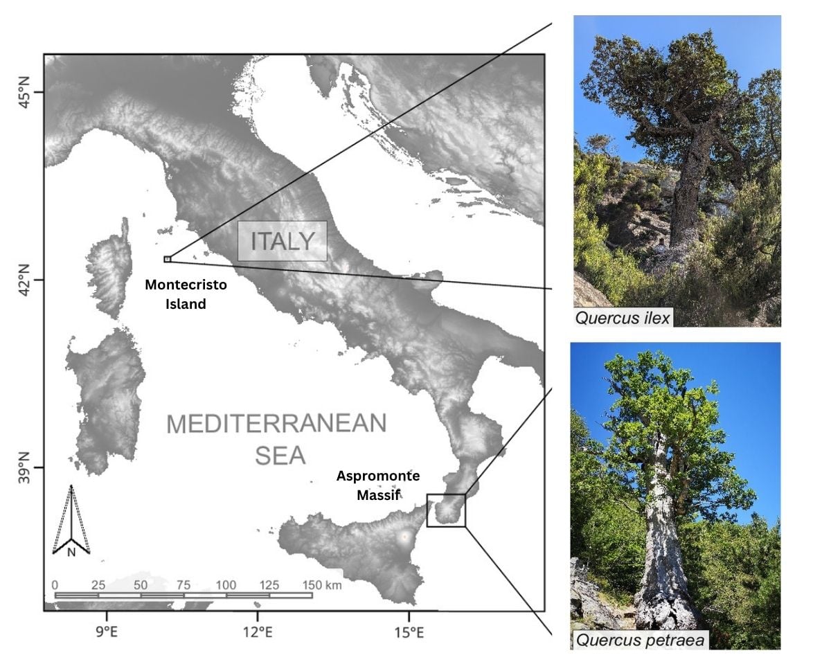
Tracing Medieval Rewilding Through Italy’s Ancient Oaks
A study of ancient oak trees reveals how changes in human land use allowed forests to expand across parts of Italy during the medieval period.

What are Those Clumps in Trees?
Discover why squirrels build dreys, the leafy nests hidden high in trees, and why they become easier to spot after autumn leaves fall.
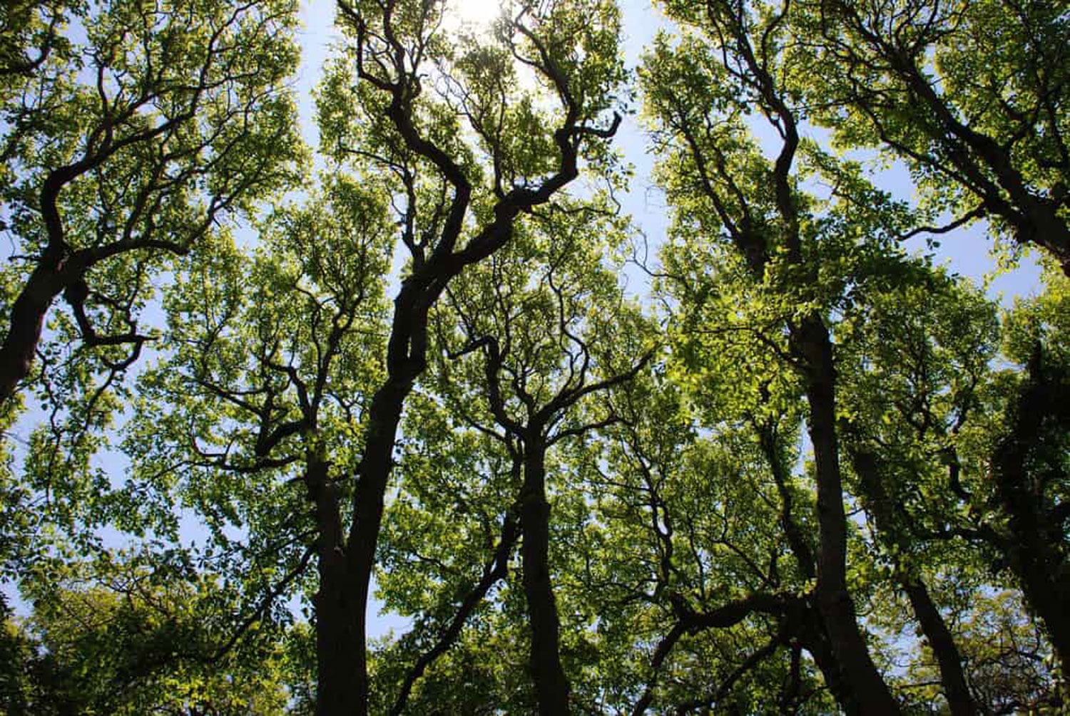
Crown Shyness: When Trees Need Personal Space
Why don't tree branches touch? Crown shyness is the natural phenomenon that creates the gaps between neighboring tree canopies.
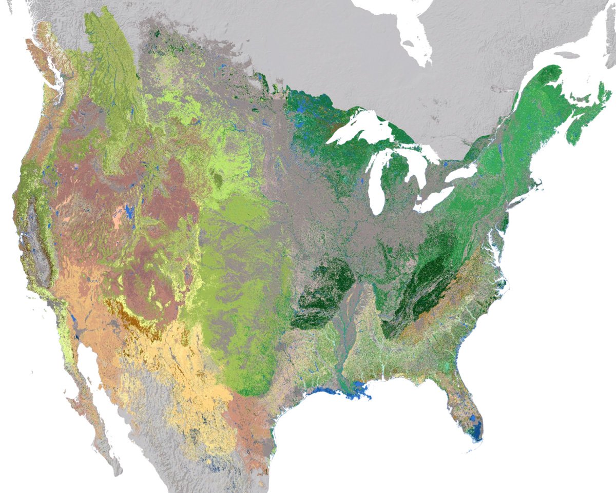
High Resolution Ecosystem Map of the Contiguous United States and Adjacent Areas
NatureServe has developed an updated 30-meter hexagon map of regional ecosystems in the contiguous United States and adjacent areas.
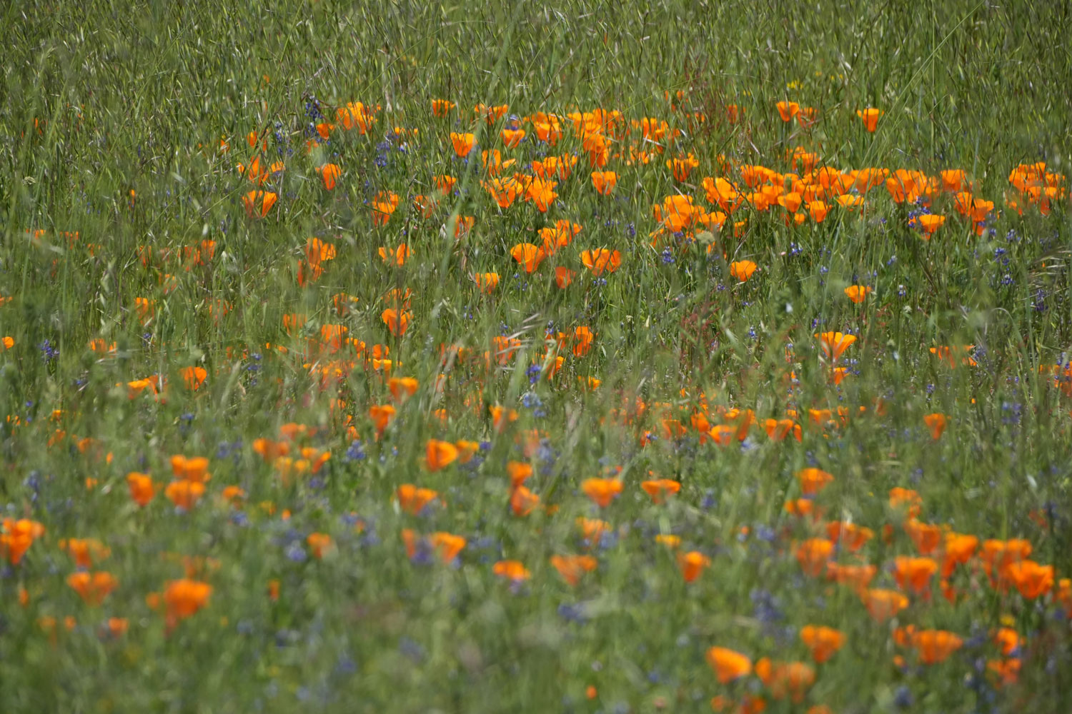
Where Superblooms Occur in the United States
Discover where superblooms occur across the United States, from California's deserts to spectacular spring wildflower displays across the West.

How Much Forest Covers the Earth Depends on the Definition
Forest cover estimates vary because there is no universal definition of a forest. Learn how canopy cover, tree height, and area thresholds affect global forest maps.

Number of “Dees” in a Chickadee’s Alarm Call is Related to the Danger Level of Nearby Predators
The number of "dees" in a chickadee's alarm call correlates with the size and threat level of the predator.

Geography of Giant Sequoias
Giant sequoias are one of the longest lived tree species, with the oldest giant sequoia living an estimated 3,400 years.

Urbanization is Shortening the Legs of Western Fence Lizards
Western fence lizards have adapted to manmade surfaces in urban areas by developing shorter limbs and toes.

Most Abundant Landbird in the United States and Canada
The American robin has the largest population among all landbirds in the United States and Canada.

How Mapping Mangrove Species Can Help With Coastal Erosion Mitigation
Species-specific mangrove maps aid conservation by targeting protection efforts and resources against storm surges and coastal erosion.

Witch’s Broom in Trees: Dense Clump of Leaves and Branches
Witch's broom affects trees like birch, spruce, and pine, causing dense twig and leaf clusters due to pathogens, parasites, and environmental stressors.

Finding Penguin Colonies from Space
Satellite observations help researchers track penguin populations in some of the most remote regions of Antarctica.

Will Cool Air Pooling Protect Some Forests from Climate Change?
Researchers looked at the link between cool air pooling and cold-adapted forest composition.

Forecasting Phytoclimates
A study of 135,153 vascular plant species predicts that by 2070, 33-68% of land on Earth will experience significant phytoclimate changes.

Human-Driven Extinction of Birds
Researchers using models and historical records estimate that up to 11% of all bird species have gone extinct since the Late Pleistocene.

This Bird is Not the Only Crested Jay West of the Rocky Mountains
Since the 1960s, blue jays have steadily expanded their range beyond the Rocky Mountains into western North America.

Measuring Tree Height with a Pair of Satellites
Using synthetic aperture radar (SAR) data from two satellites, researchers developed a method for estimating tree canopy height.

American Chestnut: the Struggle to Save the ‘Redwood of the East’
Scientists and conservationists are working to rescue the American Chestnut from going completely extinct.

Why Climate Change is Making Some Animals More Nocturnal
As daytime temperatures rise, some animals are becoming more active at night to avoid heat stress.

Individual Seabird Adaption to Climate Change
Scientists tracked the migratory patterns of 145 seabirds to map how individual shearwaters are adapting to climate change.

Using GIS to Map an Individual Animal’s Home Range
GIS can be used to model animal home ranges using location data collected through radio telemetry and GPS tracking.

Sea Otters are a Keystone Species
Keystone species are plants or animals, like the sea otter, whose presence in an ecosystem plays a crucial role in its health.
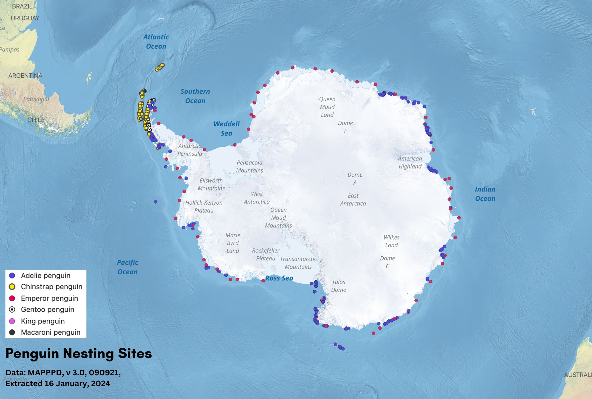
Geography of Penguins
Discover where penguins live, from Antarctic sea ice to tropical islands, and what shapes their geographic distribution.