
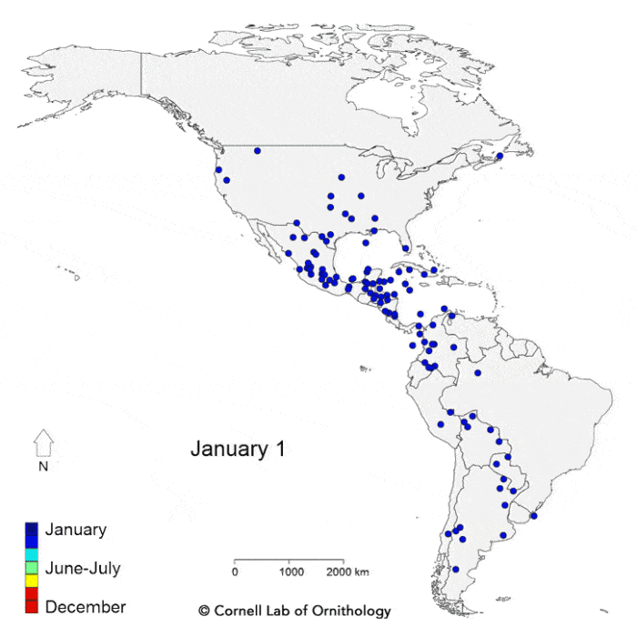
Pulling millions of observations from the eBird citizen-science database, scientists from the Cornell Lab of Ornithology have mapped out the migration of 118 bird species in the Western Hemisphere. The resulting map represents the average location over the course of a year for each of these species of birds as they make their annual migrations. A similar map with a numbered key for those wanting to know which species are which can be accessed here.
The results of the study were recently published in the Proceedings of the Royal Society B. The researchers were able to discern geographic and atmospheric influences in bird migration patterns. For example, bird species that follow a route over the Atlantic Ocean in order to winter in the Caribbean and South America take a reverse looped journey back to their spring habitat that involves a deeper inland route. The looped route allows birds to take advantage of weaker headwinds and a push from the northeast trade winds as they migrate south despite the dangers of the open ocean.
The map:

Paper:
La Sorte, F.A., D. Fink, W.M. Hochachka, and S. Kelling. 2016. Convergence of broad-scale migration strategies in terrestrial birds. Proceedings of the Royal Society B DOI: 10.1098/rspb.2015.2588.