
When considering the role of a GIS professional for your research team, what level of skill do you need?
A recently published open access journal article presents a literature review of the current applications of GIS and three case studies to help analyze the level of GIS expertise needed for interdisciplinary studies.
Three areas of GIS
The authors break down GIS needs for interdisciplinary research into three main areas: GIS as a tool, GIS as a toolmaker for custom applications, and GIS provided by someone with in-depth knowledge. The authors argue that being able to identify the GIS needs and goals is essential for obtaining the best fit in GIS expertise on a project.
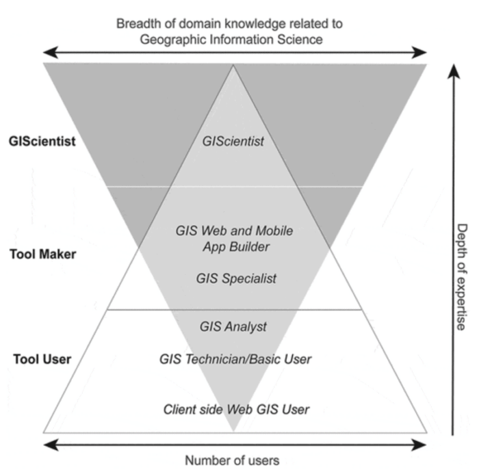
Three levels of GIS aptitude
The article defines three levels of GIS aptitude: GIS Tool User, GIS Tool Maker, and GIScientists.
The GIS Tool User can be be “defined as “light” and “heavy” both will use GIS, where the latter will do so more frequently, and both will be able to navigate around the system to perform basic tasks, acquiring more knowledge over time.”
The GIS Tool Maker are focused on designing and developing custom GIS applications.
The GIScientists are those users with advanced knowledge of methodologies for using GIS and “understand the conceptual and theoretical implications of the work to be undertaken.”

Following from these definitions, the authors present situations to consider and three cases studies to help those who need GIS as part of their interdisciplinary team to determine the right level of expertise needed.
More:
Ricker, B. A., Rickles, P. R., Fagg, G. A., & Haklay, M. E. (2020). Tool, toolmaker, and scientist: case study experiences using GIS in interdisciplinary research. Cartography and Geographic Information Science, 1-17. https://doi.org/10.1080/15230406.2020.1748113