Malaysian Airlines flight 370 disappeared on Saturday, March 8, 2014. The flight left Kuala Lumpur in Malaysia on March 8 at 12:43 a.m. local time en route to Beijing, China. Tracking of the airplane was last logged around 1:18am. Signs of the missing airplane, carrying 239 passengers and flight staff have been elusive.
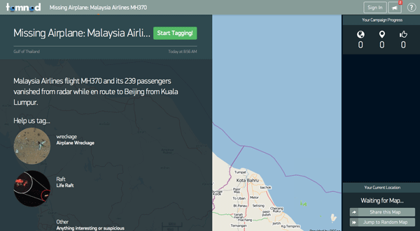
To help with the effort to locate the missing aircraft, Tomnod and Digital Globe have launched a crowdsourcing map application to bring together the power of the masses to scour satellite images that have captured the geographic area where search and rescue crews are trying to located the missing plane.
The public can help with the search effort by reviewing satellite imagery captured by two of Digital Globe’s satellites that have been trained to capture imagery of the area in the Gulf of Thailand. Users can search tile by tile for any potential signs of an airplane crash such as oil slicks, wreckage, and life rafts. Digital Globe uses an algorithm to elevate for review areas that receive a minimum number of tags from users. Those areas will be reviewed by in-house satellite imagery experts.
Crowdsourcing geospatial information has become a popular and effective way to respond to disasters with entities like Ushahidi paving the way. Those that want to help with this crowdsourcing effort need to be patient. The tiles are loading incredibly slowly as a result of the high amount of volunteers helping with the effort.
To participate visit Tomnod’s Missing Airplane: Malaysia Airlines MH370 site.