
British Pathé once provided entertaining news reels as part of the British movie going experience. Over 85,000 news videos representing the entirety of its archives have been uploaded to YouTube. The news reels span 1896 to 1976 and covers a range of news, sports, and entertainment.
Included in this collection are a number of map and cartography related reels available in a range of languages such as the 1965 Hungarian short, Aerial Photography Aids Map Makers.
World War II Cartography
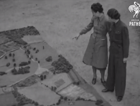
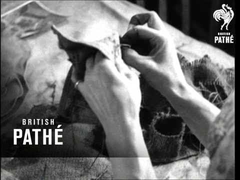
The short videos provide an insight into past cartographic techniques with a particularly strong coverage surrounding the First and Second World Wars. This 1943 video shows the map making process of the Women’s Voluntary Service which made 3D maps for the British Army on Hessian mats. The maps were created using cloth, wood, and paint and were modeled from aerial photographs. The completed maps were used by War Office instructors.
Cartography from the 1960s
Another video takes a look at cartographic technologies available in 1961:

There are many more maps ranging from “The world is round” from 1935 to a look at crime map analysis at Scotland yard in 1958. John Krygier from the Making Maps blog has a list of the map related new reels. To access the entire 85,000+ news reels, visit British Pathé’s YouTube page.