
Cartopareidolia is the tendency to see familiar shapes, such as animals, faces, or objects, in the outlines of geographical features on maps.
What is pareidolia?
Pareidolia is a cognitive phenomenon in which the brain perceives meaningful patterns in random or ambiguous visual information. A common example is seeing shapes in clouds or faces in everyday objects.
This tendency comes from the brain’s ability to quickly identify familiar forms in our surroundings. While this pattern recognition helped humans identify threats, food, or other people, it also causes us to assign meaning to shapes that are actually coincidental.
What is cartopareidolia ?
Cartopareidolia applies this phenomenon to geography and maps. Coastlines, islands, lakes, and political boundaries often resemble familiar figures once someone points them out.
Some examples have become deeply embedded in popular culture:
- Italy is a peninsula extending into the Mediterranean Sea that is often called the “Boot of Europe” because its long, narrow shape resembles a high-heeled boot.
- The Florida Panhandle gets its name from its long, narrow shape, which resembles the handle of a frying pan extending from the main body of the state.
- Lake Superior has been compared to the head of a wolf.
Once a resemblance is noticed, it can become difficult to “unsee.” Social sharing, memes, and online discussions reinforce these interpretations and encourage people to search for new examples in maps and satellite imagery.
Cartopareidolia memes on social media
Social media has amplified cartopareidolia by turning map-based visual comparisons into a popular form of internet humor. Users regularly share maps and satellite images alongside drawings of the shapes they resemble.
Examples include:
- A world map that resembles a cat playing with a ball
- A map of Brooklyn that looks like an ice-skating dragon
- Australia appearing as part dog and part cat
- A satellite image of Venice resembling Patrick Star from SpongeBob SquarePants
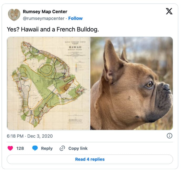
- The Hawaiian Islands compared to the shape of a French bulldog
The map of the world is really just a cat playing with a ball
Seeing an ice skating dragon in a map of Brooklyn
A map of Australia is half dog’s head and half cat’s head
Seeing Patrick from SpongeBob SquarePants in a satellite image of Venice
Imagining a map of Hawaii as a French bulldog
Part of the appeal of cartopareidolia is that it blends geography with visual perception. It turns maps into something interactive, encouraging people to look more closely at landscapes and coastlines through the lens of pattern recognition.
There is also a playful element to it. Seeing the world map transformed into a cat playing with a ball or an island chain resembling an animal gives people a new way to view familiar geography, which is part of why these images are so widely shared online.
This article was originally published on March 29, 2019 and has since been updated.
For purposeful maps displaying animals and people
- Zoomorphic Maps: Imagining Maps as Animals
- Maps as People: Anthropomorphic Maps
- Japanese artist Kentaro Nagai shifts the world’s features around to make animals out of maps: Turning the Continents of the World into Animals
