
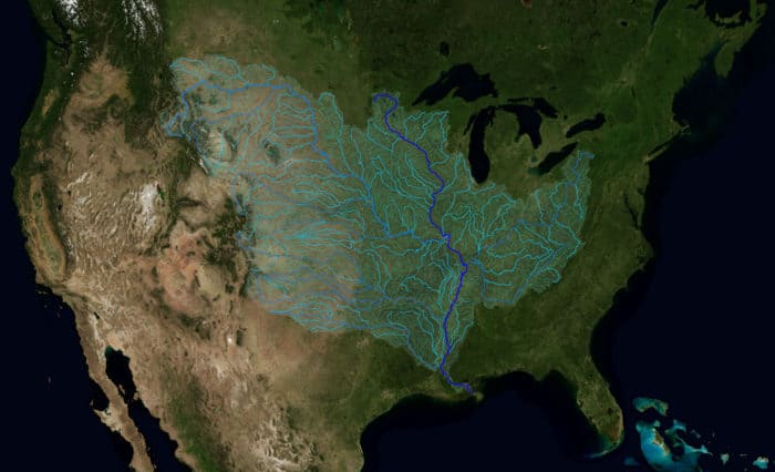
The Mississippi watershed is the largest drainage basin in North America with an area of 3.2 million square kilometers (1,245,000 square miles). The extent of the watershed reaches 32 U.S. states and two Canadian provinces.
The area of the watershed covers 40% of the landmass of the contiguous United States. The Mississippi River watershed is the fourth largest in the world. The watershed extends from the Allegheny Mountains in the east to the Rocky Mountains in the west.
The watershed contains many tributaries. The Mississippi-Missour River combination is the fourth longest in the world. Starting at the source at Lake Itasca, Minnesota, the Mississippi River flows south for 3,730 km (2,320 miles).
The basin empties into the Gulf of Mexico, about 160 km (100 miles) downstream from New Orleans.

Mount Elbert in Colorado is the highest point in the watershed at 14,440 feet (4,400 m).
Watch: Geography facts about the Mississippi Watershed
