
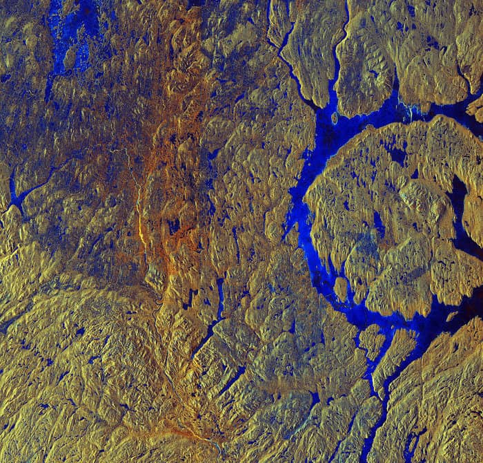
Manicouagan Crater, located in Canadian province of Québec, is one of the Earth’s oldest and the most visible impact craters. Manicouagan Crater was formed by an asteroid strike over 214 million years ago. Like a pebble creating ripples when dropped into water, the crater has concentric rings formed by shock waves transmitted by the impact.
The most prominent feature of the crater is its 70 km (40 mi) diameter inner ring. The total diameter of the concentric rings is 100 km (60 mi) across. The rim-to-diameter measurement makes it the sixth-largest confirmed impact crater.
The crater contains an annular lake (a circular lake caused by the impact of a meteor) called Manicouagan Reservoir which surrounds René-Levasseur Island. Together, the lake and the roughly 2,000 km2 island are known as the “eye of Québec.”
This false-color satellite image of Manicouagan Crater was captured by Sentinel-1A on March 21, 2015. The blue in the image shows the areas of ice and some water. Yellow and orange tones indicate aging vegetation of different types, mixed with patches of snow and ice.

