Launched on April 3 and reaching operational altitude on April 11, the first images captured by the European Space Agency’s (ESA) Sentinel-1A satellite have been made public.
The first of five satellites planned for the Sentinel group, Sentintel-1A will be tasked with gathering all-weather, day and night radar images. Imagery and data collected from the Sentinel satellites will be used in the European Commission’s Copernicus environmental monitoring program.
Back in November of 2013, the ESA announced a policy of “free and open access” to data collected from the Sentinel satellites.
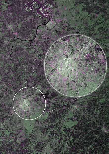
Although not yet in operational orbit, the very first sample images collected from Sentinel-1A were focused over Brussel Belgium, capturing the seat of the European Commission (low resolution: (2.23 MB), high resolution: (6.12 MB). Calibration of the satellite for supplying true data will take about three months to complete

Images acquired using the “strip-map” mode will be used for such applications as urban planning, monitoring agriculture, mapping deforestation, and managing water resources.
Sentinel-1A also captured flooding of the Zambezi river in Namibia on April 13. Sentinel-1A is able to capture images of areas obscured by darkness or cloud cover. For example, the image below was taken during a period of heavy cloud cover over the Caprivi plain.
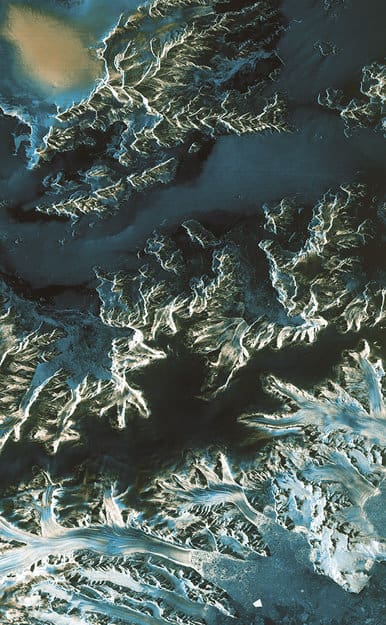
Acquired on 13 April 2014 at 03:50 GMT (05:50 CEST) by Sentinel-1A, this image shows the extent of flooding in the Caprivi plain from the Zambezi River in Namibia. Sentinel-1A acquired this image in its main ‘Interferometric Wide Swath’ mode with a swath width of 250 km and in dual polarisation. Victoria Falls is also featured in the image, further east along the Zambezi River. The image was downloaded two hours after acquisition and the resulting products were available in less than an hour. Such images can be taken in adverse weather conditions and during the dark, demonstrating the value of Sentinel-1’s radar vision. Source: ESA.Sentinel-1A also captured imagery from Antarctica. The image below demonstrates how radar signals are reflected differently depending on the presence of land, water, and ice. Data from these images can be used to help with polar marine navigation by differentiating between the thinner first-year ice areas which are more navigable than the more dangerous and thicker older ice areas. Data collected by Sentinel-1A will also be used to monitor glaciers and ice loss in the area.

