
urban planning

Using AI to Design Cities
Researchers now are trying to use artificial intelligence techniques, including deep reinforcement learning, to design more efficient and sustainable urban spaces.

What are Desire Paths?
Desire paths (also known as social trails) form when people or animals consistently take direct routes instead of using designated paths.

These Cities are the Most Unaffordable Places to Buy a House in the World
Urban Reform Institute and Frontier Centre for Public Policy evaluated housing markets for 92 metropolitan areas in eight countries to see how affordable they area.

What are 15-Minute Cities?
What if you could get from home to your job to the grocery store to the park, all in 15 minutes?

Improving Urban Decision Making with Open Earth Observations
Steven Ramage, Head of External Relations, Group on Earth Observations (GEO), outlines innovative partnerships and activities GEO has been working on globally using open Earth data, GIS, and cloud technologies.

With Only Numbers and No Street Names, This Norwegian Town is Confusing Tourists
A Norwegian municipality decided to only give the chalets in a development numbers with no corresponding street names.
What is Necrotecture?
Necrotecture is an urban planning coined termed by Rowland Atkinson to describe the "dead residential space" created by a high density of mostly vacant residential dwellings.

Free Urban Planning GIS Book and Exercises
An open access book focusing on the use of GIS in sustainable urban planning and management includes six chapters containing exercises and GIS data.

Using GIS to Study Gentrification
Amid US gentrification trends, municipalities are increasingly using GIS to study its impacts.
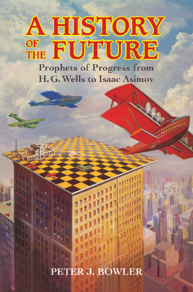
Review | A History of the Future
The History of Future presents a survey of the history of futuristic predictions from the nineteenth century on through the first two-thirds of the twentieth, in the English-speaking world

Visualizing the Impact of Gentrification
Graphic designer Herwig Scherabon has developed a book visualizing the impacts of gentrification in a number of cities in the United States and United Kingdom. Combining public access data and research with crisp visuals, Scherabon illustrates the spatial distribution of gentrification and examines the different issues at play.

Defining Urban Sprawl
The urban sprawl concept caused researchers to dive into figuring out what city in the world is the biggest based on the size of its urban sprawl.
Sub-surface Mapping and Subterranean Data Representation
ArcGIS Online advances sub-surface mapping with 3D options, enhancing design, accessibility, and customization for urban planning and transportation.


Automatic Acquisition of 3D City Models
This concept paper on the automatic acquisition of 3D city models was written by Venugopalan Nair who is the Senior Manager of Geo Spatial Services at SBL.

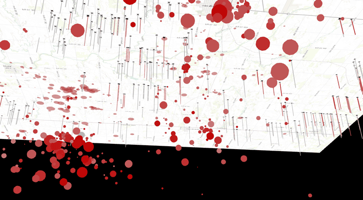
Tracking Populations Using Sewage
Scientists and researchers have recently begun tracking the populations of cities in the United States using the amount of sewage produced.

How to Build a Smart City in Twenty Steps
Lessons learned from urban planning projects around the world have been summarized into a short, 20-step do-it-yourself guide to building a Smart City.

GIS in Urban Planning
Frank Stafford, a graduate of Cambridge University with a background in Civil Engineering writes about why GIS is being used in Urban Planning.

When Streets Have No Trees
The presence of trees in cities yields multiple benefits.

The Urban Observatory Uses GIS to Seek to Better Understand Cities
The Urban Observatory is a live museum that allows access to a large amount of data about major cities around the world. The observatory allows users to compare and contrast a wide variety of GIS data covering areas such as water distribution, power grids, street networks, population density, public transit, and open public spaces.
What is Geodesign?
Recent progress with the use of technology to analyse data from various sorts to a very fine level of granularity ...