
GIS Software
Information about GIS software and applications including both commercial and open source GIS applications. This category covers desktop GIS (Esri’s ArcGIS suite, MapInfo, QGIS, and GRASS) as well as web mapping, GIS apps, mobile GIS, and component GIS.

Shapefile Viewers
Explore viewers for visualizing GIS vector data in shapefile format, available for both desktop and web browsers.
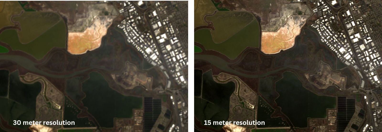
Pan Sharpen Landsat Imagery in QGIS
This QGIS tutorial guides you through pan sharpening Landsat imagery by combining the 15-meter panchromatic band with lower-resolution multispectral bands.

How to Use Esri File Geodatabases in QGIS
Learn how to load both Esri vector and raster file geodatabases in QGIS.

Little Known QGIS Parlor Tricks
The coordinate box in QGIS is one place where you can uncover neat little GIS mapping tricks.
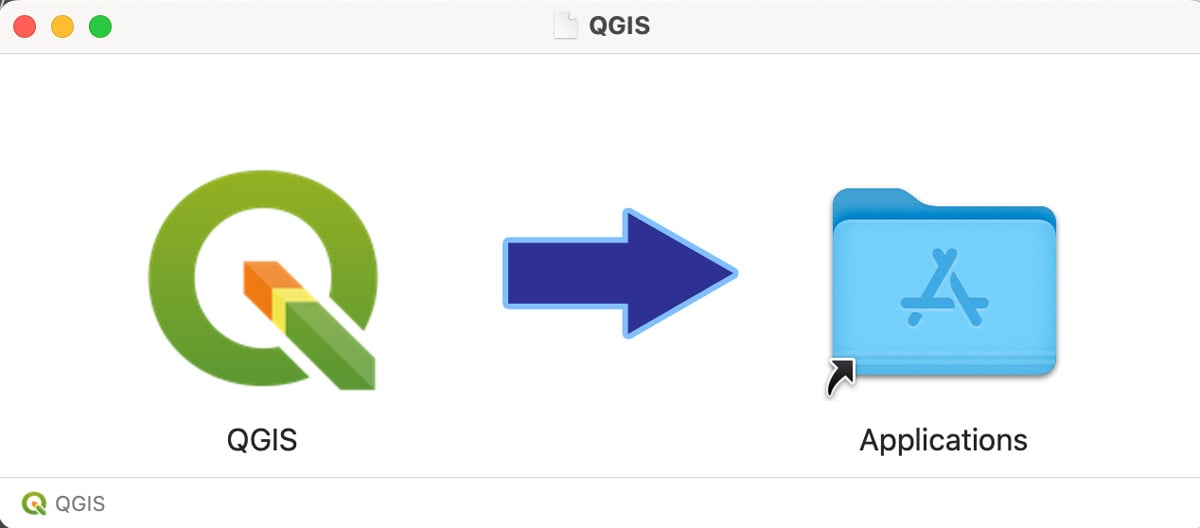
How to Install QGIS on a Mac Computer
Follow these step-by-step instructions on how to install QGIS on a Mac.
Learning GIS Programming
Having some competence in programming has become a critical requirement for many geospatial positions. So which languages should you learn for GIS programming?

Collecting GIS Data in the Field Using QGIS and QField
This QGIS tutorial takes you through the steps to synchronize a map project with QField in order to collect GIS data using a mobile device.
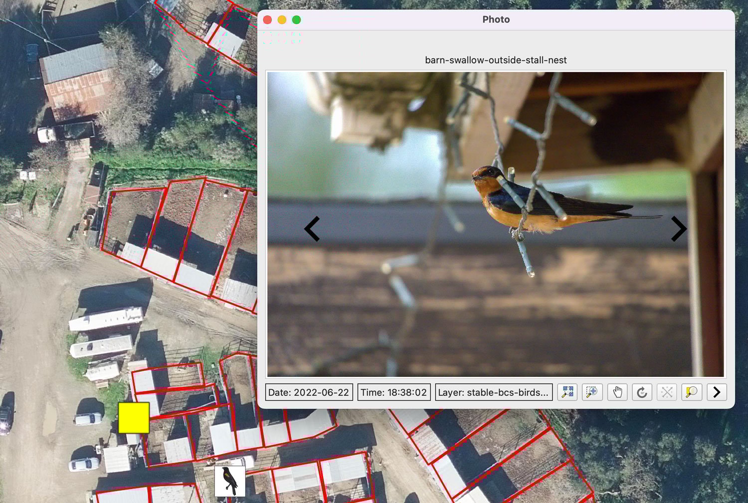
Mapping Geotagged Photos in QGIS
Geotagged photos can be easily mapped out in QGIS by following this GIS tutorial.
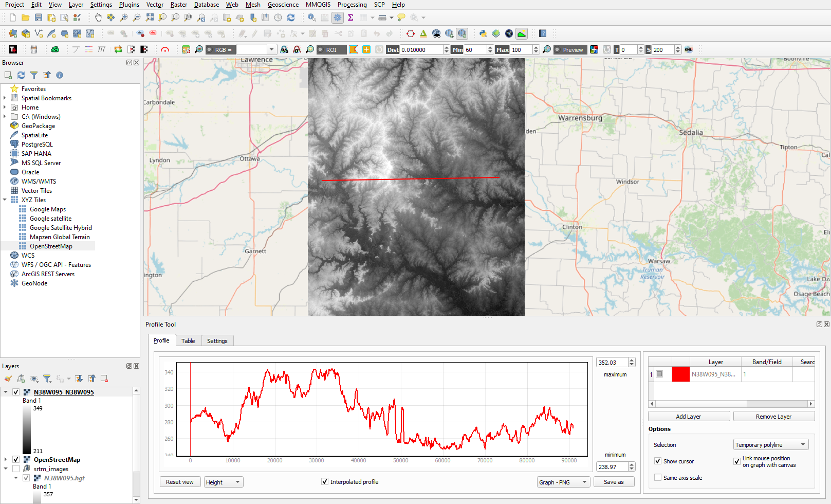
Creating Elevation Cross-Section Profiles with QGIS
Learn to create elevation cross-sections in QGIS with the Profile Tool plugin and SRTM elevation data.

Using QGIS to Create Isochrone Maps and Identify Shortest, Fastest Routes
Learn how to use QGIS, OpenStreetMap, and the ORS plugin to find shortest and fastest routes and to create 10 and 15-minute isochrone maps.

Getting Started with the ArcGIS Business Analyst Web App
This GIS tutorial provides a brief introduction to using the ArcGIS Business Analyst Web App.

What is PostGIS?
PostGIS is an Open Geospatial Consortium (OGC)-compliant software that serves as an extension for PostgreSQL, an object-relational database.

Mapping Buildings in 2.5D Using ArcGIS Pro
Learn how to find and use building footprint data from OpenStreetMap to create a 2.5D map in ArcGIS Pro.

Five Reasons to Start Using QGIS
Here are five compelling reasons to start using the open-source GIS platform QGIS, a free and open source software.

How to Use the Suitability Modeler in ArcGIS Pro
Learn how to use the suitability modeler in ArcGIS Pro to map out suitable areas given a set of criteria.

R Packages for Spatial Analysis
Looking for R spatial packages? Listed here is a brief look some of the spatial packages in R that are available.
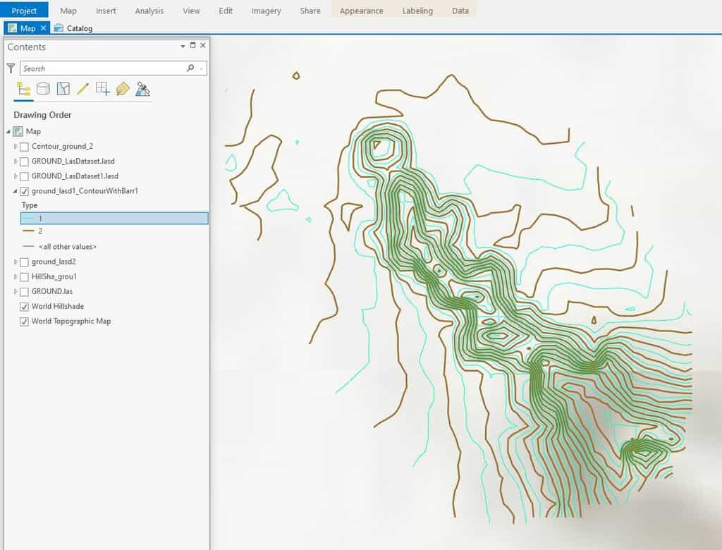
How To Create Contours in ArcGIS Pro from LIDAR Data
This ArcGIS Pro tutorial shows how to add LIDAR data from the National Map to ArcGIS Pro and create topography contours.

Open Source GIS and Freeware GIS Applications
There are many open source GIS and web mapping applications to choose from.

Using GIS to Map Fly Fishing Destinations
William Bakemeyer describes how he used QGIS and open source data to create a fly fishing map.

QGIS from a Graduate Student’s Perspective
Kent Campbell writes about how he has come to view the benefits of using QGIS as a graduate student.

Crowdsourcing Archaeological Data with Participatory GIS
People with little or no training in archaeology or geographic computing systems can build GIS data using Humap's Placemaker.

How to Add Data from ArcGIS Online to QGIS
Adding data from an ArGIS Online Map Service or Feature Service into a QGIS map project is fairly easy and quick in most instances.
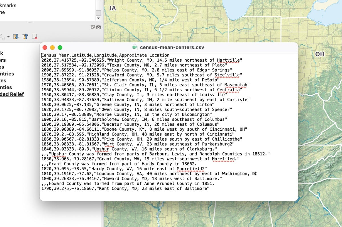
How to Add Latitude and Longitude as a CSV File in QGIS
This quick QGIS tutorial takes you through the steps of how to add a CSV file with latitude and longitude coordinates.

How to Use ArcGIS Pro for Supervised Classification
This ArcGIS Pro tutorial provides a step-by-step guide for performing supervised classification on Landsat 8 imagery using remote sensing and GIS techniques.

Fluid Earth: Open-source Visualization of Weather and Climate Data
Fluid Earth is a web visualization tool developed by The Ohio State University's Byrd Polar and Climate Research Center (BPCRC) that enables users to view weather and climate patterns.
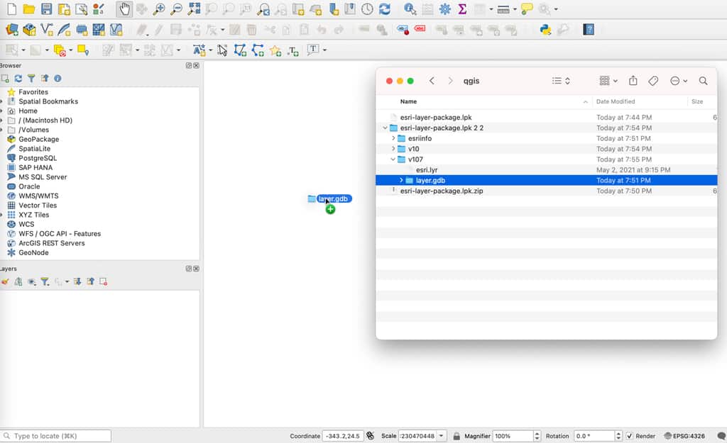
How to Import an Esri Layer Package in QGIS
While QGIS cannot directly read an Esri layer package, there is a simple technique to unpack the file and import it into this GIS software.