
EOMAP has released a mapping application designed to track harmful algal blooms (HAB) in Lake Erie.
Pulling data from US and European satellite sensors about turbidity and chlorophyll, the app tracks blue algae blooms which are harmful to Lake Erie’s ecosystem, causing aquatic dead zones.
In addition, algae blooms are a danger to drinking water, aquaculture industries, and the public welfare. NOAA has recently issued warnings about Microcystis cyanobacteria blooms in the lake.
Tracking Algae Conditions Daily
The algae bloom monitoring program developed by EOMAP for the Great Lakes region now tracks algae conditions daily.
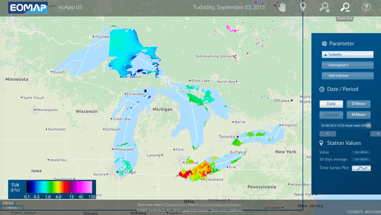
Three different parameters can be viewed on the algae bloom map: turbidity, Chlorophyll-a, and Harmful Algae Blooms (HAB) indicator.
Turbidity which is the degree to which light is being backscattered by particles in the water. This measurement is useful for monitoring sediment plumes from dredging and dumping activities. In addition, tracking Chlorophyll-a is important for measuring of phytoplankton.
The HAB indicator parameter shows possible areas affected by harmful algae blooms formed by cyanobacteria containing phycocyanin.
Aggregated Algae Bloom Data
In addition to daily conditions, EOMAP’s eoApp-US also provides spatially and temporally aggregated data: daily means (D’mean) and moving, weekly means (M’mean).
The app uses an algorithm developed by EOMAP to detect blue algae containing phycocyanin pigments.
Users can try out the app by visiting EOMAP’s eoApp US page.
