
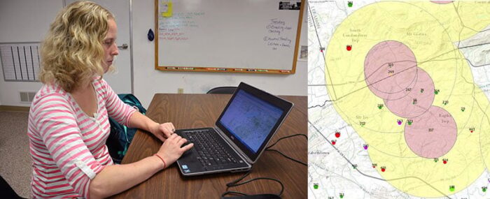
Dr. Meghann Pierdon with the University of Pennsylvania’s School of Veterinary Medicine has developed a secure website that uses GIS to map out the incident of diseases among pigs or birds.
Updated quarterly, the map highlights current and emerging disease hot spots as well as areas that may be at risk. The map provides disease status detail about 542 swine farms which represents about 90% of the state’s domestic pig population.
The map, hosted by pharmaceutical company Boehringer Ingelheim, is also updated by swine veterinarians. Poultry data comes in from the lab system. The map then uses GIS to pinpoint disease locations by farm.
When outbreaks occur, program members are notified so that preventative measures such as not traveling from an infected farm to a non-infected farm, can be undertaken. Pierdon also collects data from neighboring Maryland, Delaware, and New Jersey.
