
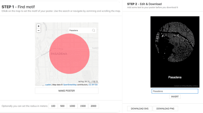
Figuregrounder by Hans Hack is a fun tool that lets you create a simple map poster in seconds. The tool works by creating a simple white on black (or the inverse) map poster of building footprints.
How to Create a Map Poster
First, either zoom and pan or do a location search for a location on earth. Click on the map to select the point around which to create the map poster. Next, set the radius around the area you want to capture. This can be either 100, 500, 1000, 1500, or 2000 meters.

Export the Map Poster
In Step 2 give your poster a name. Last, choose the download option. For a low resolution file, select the PNG download. If you want a higher resolution file, select the SVG option.

You can then open up the file in an application like free and open source Inkscape and make any adjustments you need.
Visit:
