The Aorounga Crater in Northern Chad

Caitlin Dempsey

FIrst published:

Updated on:

Aorounga Crater, Chad. Image: JAXA/ESA, 2010.

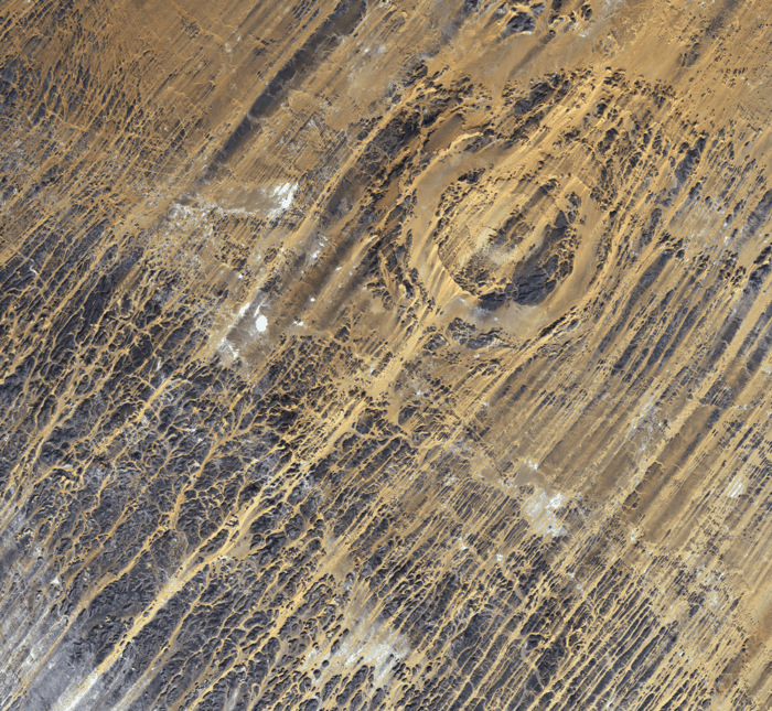
The Aorounga Crater is an impact crater located in northern Chad just south of the Tibesti Mountains in the central Sahara desert. Measuring 12 kilometers across, the crater was formed about 340 million years ago by the impact of a meteorite.  At the center of the crater is a dark peak, or central highland, caused by material splashing up after the impact.  This peak is surrounded by a small sand-filled trough.  That trough is ringed by rocks.

Map showing the relative location of the Aorounga Crater in northern Chad. Map produced by Geography Realm from Natural Earth data.
Map showing the relative location of the Aorounga Crater in northern Chad. Map produced by Caitlin Dempsey from Natural Earth data.

The linear ridges found crossing the crater are known as yardangs.  These ridges are formed by wind erosion which exposes rock layers.  The winds crossing the Aorounga Crater are unidirectional and flow from the northeast causing the sand dunes between the yardangs to migrate to the southwest.

Japan’s ALOS satellite captured the above image of the Aorounga Crater on November 3, 2010.

See Also

Photo of author
Caitlin Dempsey
Caitlin Dempsey is a geographer, writer, and the founder and editor of Geography Realm. She holds bachelor's and master's degrees in Geography from the University of California, Los Angeles (UCLA), as well as a Master of Library and Information Science (MLIS) from San José State University. She has been writing about geography, maps, geographic information systems (GIS), and environmental topics for more than two decades through Geography Realm and its predecessor site, GIS Lounge. Her interests include cartography, remote sensing, environmental geography, and the relationship between people and place.