
Repeat photography is the practice of taking photographs of the same location years and even decades apart. By capturing the same view, researchers can study how the landscape is changing over time. Changes in water features, glaciers, and human activity all can be understood by comparing historical photographs with current day imagery.
The USGS and the National Park Service have been active in using repeat photography to understand landscape changes. The USGS has a multitude of studies covering a wide range of geographic areas such as the Southwest Desert and Baja California to how the Klondike Gold Rush National Historical Park has changed since the Gold Rush.
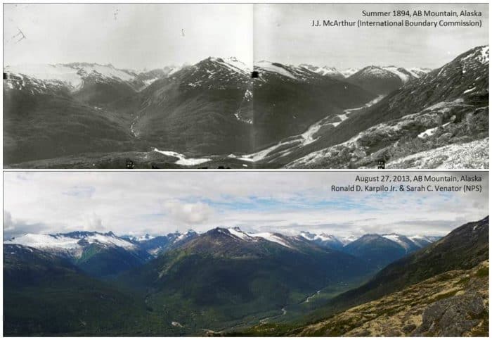
For example, this photo from the Klondike Gold Rush National Historical Park compares summer views northwest towards West Creek and the Taiya River from AB Mountain taken 119 years apart. The span of over one hundred years has shown the landscape changes with glacial thinning and retreat, channelization of the Taiya River and regrowth and thickening of the forest in the valley bottom.

More:
- Then and Now: Capturing a Century of Change, Klondike Gold Rush National Historical Park
Watch: Repeat photography | Over a century of change in Klondike Gold Rush National Historical Park
