
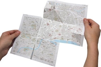
Called map2, the uniqueness about this map of London is the patented folding technique that allows the viewer to either view a large scale map or to fold out sections to see the zoomed in area. The folding and unfolding reminds me of origami in the demonstration video so I hope the real world use of this map is just as smooth. (Visit my earlier post on Origami Maps to find other examples of unique map folding techniques.) The patent for this type of map folding seems to have been submitted back in 2004 by Anne Stauche. The idea is clever and the costs of the map for London is listed as £ 8.00 which seems reasonable. So far, only a map of London is available for sale, no further information was available as to any plans to expand to other cities.
Visit: map 2 – the Zoomable Map on Paper

This would have been so helpful when my wife and I were on our honeymoon in London a couple of years ago!