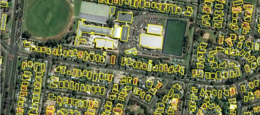
Microsoft has released 11,334,866 building footprints covering the country of Australia.
The GIS dataset was generating by applying Bing Maps algorithms on satellite imagery. As with previous releases for other countries, this dataset is freely available for download and use under the Open Data Commons Open Database License (ODbL).
Microsoft has been using artificial intelligence driven algorithms to detect building footprints from Bing satellite imagery and releasing them as open data. Previously, Microsoft has released open building footprint data for the United States, Canada, and Uganda/Tanzania.
Related: Microsoft Releases Canada Building Footprint Database to OpenStreetMap and 125 Million Building Footprints in the US Now Available as Open GIS Data
For these countries Microsoft has released:
- 124,885,597 footprints in the United States
- 12,663,475 footprints across all Canadian Provinces and Territories
- 17 million country-wide open building footprints datasets in Uganda (7 million) and Tanzania (11 million)
The goal of Microsoft’s efforts to create AI-driven building footprint datasets is to “increase the coverage of building footprint data available as open data for OpenStreetMap and humanitarian efforts.
The Australian building footprint layer can be downloaded from Microsoft’s Github.

