
Last year, the Farm Service Agency (FSA) starting floating the idea of charging a licensing fee for its high resolution imagery of the United States starting in 2019. Now, an article in Nature is reporting that the Department of the Interior (DOI), which oversees the USGS, has tasked a federal advisory committee with exploring how instituting a fee for Landsat data might impact scientists and other users. If implemented, a fee structure for Landsat data would be a departure from the Department of the Interior’s current policy of releasing its Landsat products for free to the public.
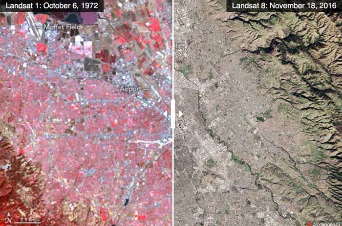
Since 2008, researchers have been able to freely access the entire Landsat archive. An article produced in 2015 by the USGS entitled “Free Data Proves Its Worth for Observing Earth” notes that while $3.5 billion is spent by the US government on “civil earth observations and data (including Landsat and other satellites, weather, GPS, etc.),” the benefits derived from this investment result in a ten-fold increase: “Federal investments in various aspects of earth observation are conservatively estimated to add $30 billion to the U.S. economy each year by providing Americans with critical knowledge about natural resources, climate and weather, disaster events, land-use change, ecosystem health, ocean trends, and many other earth-related phenomena“.
The analysis from the federal advisory committee is due later this year.
More:
- US government considers charging for popular Earth-observing data, Nature 556, 417-418 (2018). doi: 10.1038/d41586-018-04874-y
