
Kambalny Volcano is a stratovolcano with a summit height of 7071.68 ft (2156 m) which is located in the southern part of Kamchatka Peninsula, Russia (N 51 deg 18 min E 156 deg 52 min). While the Kamchatka Peninsula has the highest concentration of active volcanoes on Earth, until recently the volcano had been dormant, with the last recorded eruption happening in 1769, 248 years ago.
On March 24, 2017, the volcano erupted and evidence of the eruption was captured by multiple satellites shortly after.
The Moderate Resolution Imaging Spectroradiometer (MODIS) on NASA’s Terra satellite captured the ash plume from the volcano on March 25th. The day after the eruption, the ash plume had extended 100 kilometers (60 miles) to the southwest.

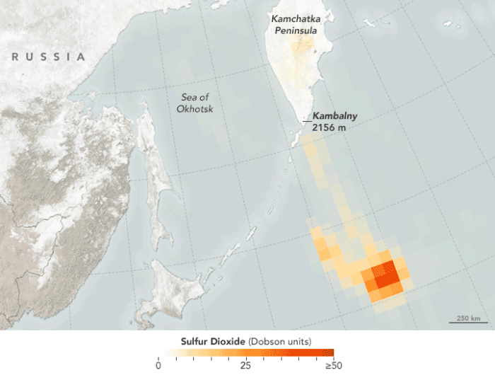
On March 26th, the Ozone Monitoring Instrument on NASA’s Aura satellite recorded an airborne plume of sulfur dioxide (SO2).

Related
- Europe’s Largest Active Volcano
- What Are the Negative Impacts of a Cinder Cone Volcano?
- Largest Dome Volcano in the World
- A Harbor in the Center of a Volcano
- Geography Facts About the World’s Largest Active Volcano
- The Earth’s Only Active Volcano Known to Emit Natrocarbonatites
- Earth’s Largest Shield Volcano
- Europe’s Largest Active Volcano