
Not all maps are draw from a plan view, that is, a map that looks directly down on the geographic area being depicted. Cartographers have experimented with showing geographic areas from different angles for centuries.
One of these types of map perspectives is the bird’s-eye view map.
Bird’s-eye maps
Bird’s-eye maps are drawn from an elevated vantage point. As the name suggests, these maps show an area as if viewed from above, as if by a bird in flight.
Other names for bird’s-eye maps
Bird’s-eye maps are also known by a variety of names such as panoramic maps, perspective maps, oblique maps, and aero views.

Bird’s-eye maps are frequently used to depict the layout of a city or region and can be extremely useful for gaining an understanding of an area’s overall layout and organization. Bird’s-eye maps are a stylistic cartographic technique that is typically not drawn to scale.
The term “bird’s-eye view” refers to how the map appears when viewed from the perspective of a bird flying above the area.

Bird’s-eye maps were very popular in the late 16th and early 17th century Europe to showcase urban areas. Mathias Merian, George Braun, and Franz Hogenberg are some of the prominent cartographers producing bird’s-eye maps in Europe during that time.
In the United States and Canada, bird’s-eye mapping became population during the late 19th and early 20th centuries.
Albert Ruger, Thaddeus Mortimer Fowler, Lucien R. Burleigh, Henry Wellge, and Oakley H. Bailey were prolific cartographers who produced panoramic maps of U.S. and Canadian cities at the time.
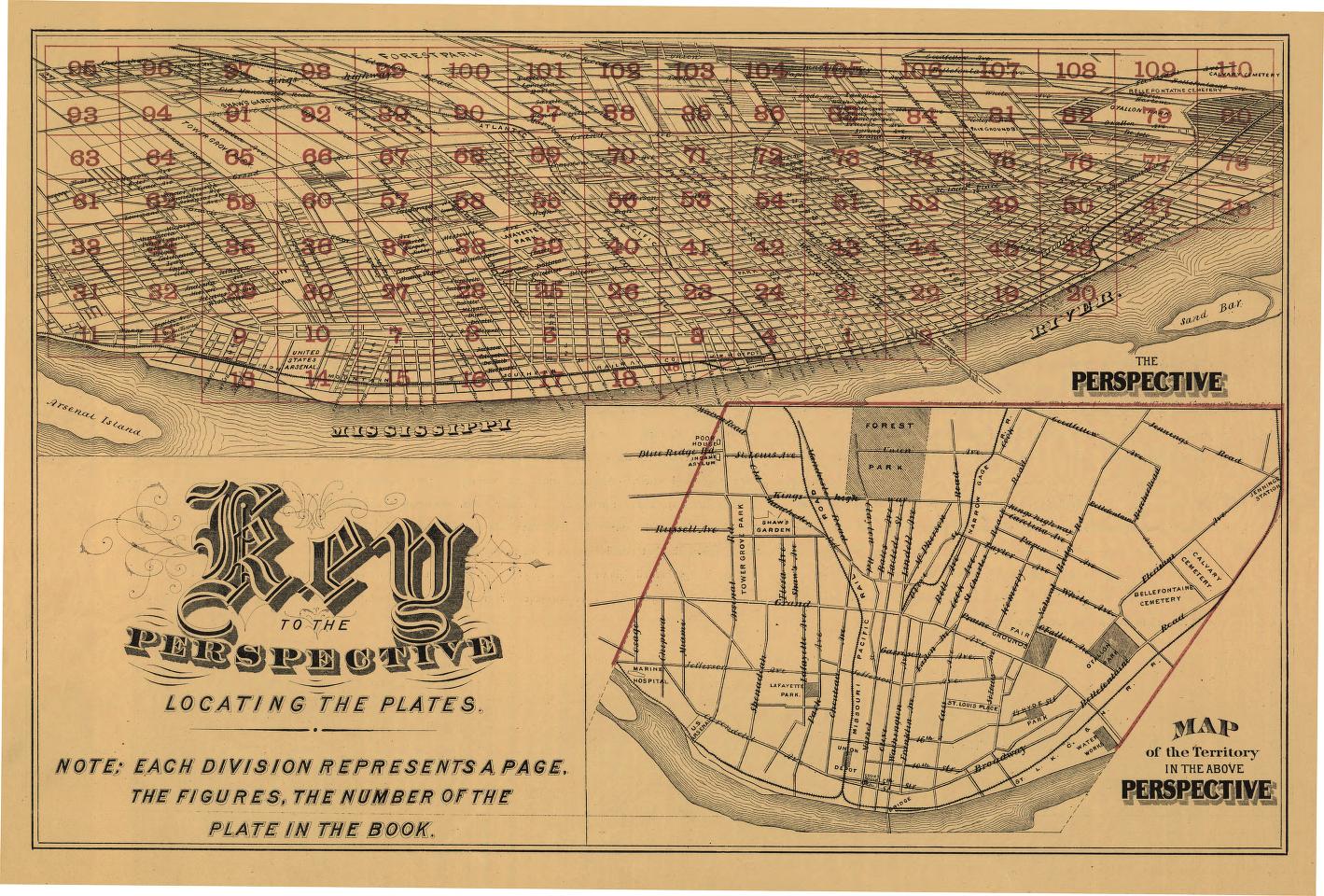
Largest panoramic map

The largest panoramic map produced measures 9 by 24 feet. Published in 1875 by Camille N. Dry, the Pictorial St. Louis; The Great Metropolis of the Mississippi Valley is a panoramic map produced over 110 sheets as at atlas. The atlas was designed to be assembled if desired into a large panoramic map.
The black line-drawing maps each contain a high level of detail, showing buildings, boats along the waterfront, and even people gathered in the streets of St. Louis.
References
Panoramic mapping. (n.d.). The Library of Congress. https://www.loc.gov/collections/panoramic-maps/articles-and-essays/panoramic-mapping/
Pictorial St. Louis – The great metropolis of the Mississippi Valley. (2022, December 13). Library of Congress Blogs. https://blogs.loc.gov/teachers/2022/12/pictorial-st-louis-the-great-metropolis-of-the-mississippi-valley/