
In 1858, French photographer Gaspard-Félix Tournachon used a hot air balloon to take an aerial picture over Paris, France — he had no idea what he was starting. He effectively launched an aerial imaging industry that over the years has used everything from balloons, kites, blimps, helicopters, planes, drones, satellites, and spaceships to capture aerial images.
How Big is the Aerial Imaging Market?
Today’s aerial imaging market is estimated at $2.26 billion and is expected to reach $8.52 billion by 2030. Projections indicated that the industry will grow at 15% per year over the next five years.
The use of aerial imagery has become so prolific, that most people, whether they realize it or not, use it. From simple applications such as Google Images or Google Earth to complex applications like police departments using it to cut down on crime, aerial imagery can help save time and money for individuals and businesses of all sizes and industries.
A Continuous Collection of Aerial Imagery
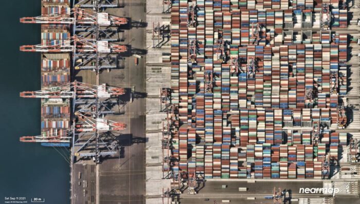
As one of the leading providers of aerial imagery, we at Nearmap approach aerial imagery a little differently than everyone else. While most of our competitors fly only when a client pays them to, we fly over parts of the United States, Canada, Australia and New Zealand two to three times a year,.

Our library of aerial imagery provides some of the most accurate imagery available throughout more than 430 markets in North America, including 1740 urban and regional areas that will account for more than 80 percent of the United States population. This approach allows our clients to make decisions based on conditions in their communities in near real-time, at a fraction of the traditional cost.
Examples of How Aerial Imaging is Being Used
To give an idea of the proliferation of aerial imaging, let me share a few examples of how it’s being used.
The Chicago police force is the second largest in the United States, behind New York City. The Chicago PD pulls aerial images to secure exact mapping data on every emergency call in the city, an area encompassing 780 kilometers. The ability to pull this data has sped up response times and has given first responders an instant sense of the environment they’re walking into.
Additionally, the data gathered is being used to scout locations for crime cameras and is available to the city’s 14,000 plus officers. Combining aerial imagery with property tax and event management data in this way provides a high degree of “predictive policing.” The results have led to a declined murder rate by more than a third in four years.

The city of Taunton, Massachusetts is home to more than 57,000 residents living within the city’s 49 square miles and more than 10,670 single family homes, 1,300 condominiums, 1,800 multifamily dwellings, and 2,500 commercial properties.
“In the city of Taunton Massachusetts, the biggest, most popular sport is construction without a building permit,” said Richard Conti, Taunton’s Assessor.
As an assessor, Conti is responsible for estimating the value of real property within the city and converting that into an assessment that is used to calculate the tax amount residents pay on an annual basis. It’s an important job that often requires assessors like him to be part accountant, part detective, and part collection agent.
“Nobody wants to be taxed. People are always hiding or trying to hide from me,” explained Conti. “My colleagues nicknamed me ‘Special Agent’ and I take that as a compliment because there’s a lot of ways to find out what you want to know now even while we’re all working remotely. I’m using all the tools I can right now to be successful at my job.”
When COVID-19 forced people to shelter in place and social distance, assessing properties became even more difficult. Taunton was already losing hundreds of thousands of dollars every year as they fought against construction projects without building permits. But the government can’t ever stop.
Conti uses aerial imagery to view and assess properties in the city remotely. Within months he was able to identify taxable properties and assets to the tune of $81,400 in increased tax revenue, which when amortized over a full year would easily surpass six figures of increased tax value. He was also able to boost the efficiency of his team by 30%.
Using Aerial Imagery to Track Major Weather Events

In addition to a global pandemic, in 2021 the U.S. saw 18 major catastrophic weather events that have exceeded more than $1 billion each in damages. Aerial imagery provides insurers with a true understanding of what’s happening on the ground so they can confidently assess policies and quickly triage claims when time matters most.
At Nearmap for example, our imagery includes a rich stack of location content, pre and post catastrophe imagery that provides insurers with actionable property insights they need to make critical decisions across the entire policy lifecycle.
Advanced technology developments and capabilities provided by the Internet of Things (IoT), LiDAR systems, geographic information system (GIS), and 360-degree vision cameras have boosted the aerial imaging market. Moving forward I see aerial imaging playing an even bigger and important role in just about every aspect of our lives.
Read next: What Imagery Source is Best for Your Business?
About the Author
Tony Agresta is the Executive Vice President and General Manager of North America, at Nearmap, a global technology pioneer, providing easy, instant access to up-to-date and historic geospatial data that organizations depend on as their source of truth for a livable world. He has been working in technology for more than 30 years and has extensive experience in sales, marketing, product management, and operations for technology companies focused on analytics, marketing automation, and mapping.