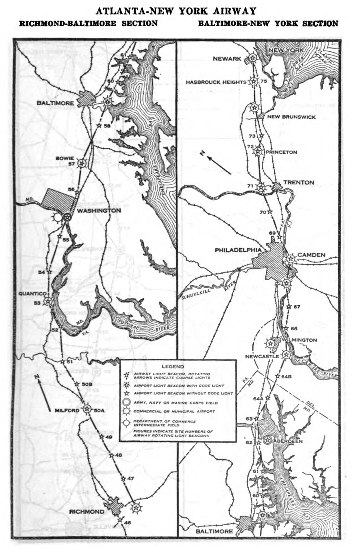
Long before the advent of radio navigation and Global Navigation Systems (GPS) to assist in air flight, the Transcontinental Airway System was developed to aid night time airmail flights.
Proposed by the National Advisory Committee for Aeronautics (NACA), the TAS was a series of beacons on concrete arrow platforms to form a sequential lighted airway stretching from the East Coast to the West Coast.
Due to low visibility and harsh weather, midnight mail delivery was nearly impossible prior to the creation of the airway system.
Prior to the establishment of the Transcontinental Airway System, good aviation charts were not available and pilots had to use visual clues to navigate across the United States.
Map: First Transcontinental Air Mail Route

The Creation of Airway Beacons to Guide Night time Airmail Flights
To open up night time flying as a way to speed up cross-country mail service, lighted airway beacons were set up spaced 1o to 15 miles apart (closer in more rugged terrain and further away on the plains).
The rotating beacons were 24 inches in diameter and were placed atop 53-foot towers. The towers were anchored onto concrete arrows 70 feet in length that were painted yellow, pointing to the next higher numbered beacon.

Brightly lit, the beacons were five million candlepower and powered by generators inside of small outbuildings next to the towers. At the top of the beacons were two color-coded course lights: green indicating an adjacent airfield and red meaning no airfield. Intermediate landing fields were setup 30 to 50 miles apart in areas where there were no airports.
The beacons were numbered and the last digit was represented by a sequence of letters “WUVHRKDBGM”. W represented 1, U represented 2, and so forth until M which represented 10. The number of the beacon light corresponded to the nearest 10-mile interval and were numbered from west to east or from south to north depending on the airway route (Department of Commerce Airway Bulletin No.1, September 1, 1932).

The course light at the top of the beacon would flash out the letter in Morse code so pilots could keep track of the beacon sequence. A pilot was able to follow the sequence of beacons by remembering the mnemonic ““When Undertaking Very Hard Routes, Keep Direction By Good Methods.”
Each sequenced beacons represented 100 miles of flight with W representing mile ten and M representing mile 100.
First Night Time Airmail Flights Across the United States
The first night time flights using the Transcontinental Airway System began on July 1, 1924. By removing the need for the transfer of mail to rail cars at night, mail delivery time from the East Coast to the West Coast was reduced by two days.
By 1933, 18,000 miles of lighted airways had been established with 1,550 rotating beacons, and 236 airfields.

The emergence of radio navigation and radar in the 1930s eventually removed the need for night time lighted airways for navigation. The beacons were decommissioned by the Department of Commerce starting in the 1940s. The last airway beacon maintained by the FAA was decommissioned on July 20, 1972, at Whitewater, California
Most of the steel towers were disassembled and repurposed, leaving only the arrow markers in place. Many of these concrete arrows are still in place around the country.
The Last Airway Beacons in the United States
Only Montana still maintained the airway beacons for flight travel until very recently. In 1972, the FAA turned over control of 17 airway beacons in Montana to the Montana Aeronautics Commission.
In 2017, the Montana Department of Transportation decided to decommission the beacon system due to the beacon system’s obsolescence and cost to the state to maintain them. In 2018, Montana began to shut down the beacons. Several of the beacons have since been adopted by private owners and agencies and continue to flash their lights.
Map of Remnant Airway Beacons

While many a hiker and tourist has come across these abandoned markers on trip around the country, armchair geographers can viewed a map of geolocated airway beacon sites on Google Maps. If you want to explored the GIS data for historic airway beacons, you can access a KMZ file from the page.
Read next: ZIP Codes in the United States
References
Air Mail Pioneers. (n.d.). FAA.gov. https://www.faa.gov/about/history/photo_album/foundation
Airway beacons -the end of an era. (n.d.). Montana Department of Transportation (MDT). https://mdt.mt.gov/aviation/beacons.aspx
Knight, H. (2015). Chicago Airmail History: McGirr and Waterman Airports. ESSAI, 13(1), 22. https://dc.cod.edu/essai/vol13/iss1/22
McCombs, A. (2010, January 10). Lighthouses. National Air and Space Museum. https://airandspace.si.edu/stories/editorial/lighthouses
Schamel, J. (2018, December 9). The development of night navigation in the U.S. Air Traffic Control History. https://www.atchistory.org/the-development-of-night-navigation-in-the-u-s/
United States. Bureau of Air Commerce. (1931-38). Airway bulletin. no. 1-2. Washington: U. S. Govt. print. off.. https://hdl.handle.net/2027/mdp.39015021076693
