
2.3 million scenes from the ASTER archive were processed to create the latest version of the ASTER Global Digital Elevation Model (GDEM).
Developed from ASTER scenes dating from March 1, 2000 to November 30, 2013, the geographic coverage extends from 83° North to 83° South.
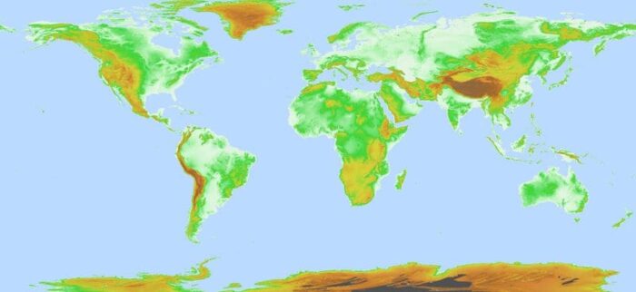
As with the previous version, Version 3 was developed with a 30-meter spatial resolution and is available in GeoTIFF format as 22,912 1°x1° tiles.

This latest release offers a new GIS data product: the ASTER Water Body Dataset. This dataset contains all water bodies larger than 0.2 kilometers in area and classified as either ocean, river, or lake. Each GDEM tile is accompanied by a corresponding Water Body tile.
The improvement in data processing means that, compared to Version 2, there has been reduction in Version 3 of elevation void areas and water area anomalies:
The methodology used to produce the ASTER GDEM involved automated processing of 2.3 million scenes from the ASTER archive, including stereo-correlation to produce individual scene-based ASTER DEMs, masking to remove cloudy pixels, stacking all cloud-screened DEMs, removing residual bad values and outliers, averaging selected data to create final pixel values, and then correcting residual anomalies before partitioning the data into 1° by 1° tiles.

Red circle: elevation void area, Blue circle: water area. Source: NASA and METI Science Teams
The development of these datasets is a partnership between the United States National Aeronautics and Space Administration (NASA) and the Ministry of Economy, Trade, and Industry (METI) of Japan. Advanced Spaceborne Thermal Emission and Reflection Radiometer (ASTER) is one of five instruments onboard NASA’s Terra spacecraft which was launched in 1999.
Both the ASTER GDEM and ASTWBD tiles are freely available and may be accessed from Japan Space Systems and from the LP DAAC via NASA’s Earthdata Search.