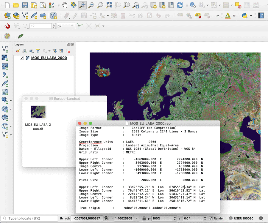
Image files such as digitized maps, satellite imagery, and aerial imagery can come in different formats. In order to use this type of imagery within GIS software, georeferencing information has to be included.
For many image types such as TIFF format and JPEG files, the georeferencing information is contained in a separate sidecar file with .tfw and .jfw extensions respectively.
GeoTIFF are TIFF files that contain spatial referencing information the form of georeferenced raster imagery. Aerial imagery (or aerial photography), satellite imagery, digital elevation models, and shaded relief are some examples of geoTiff files.
GeoTiff files can be added to GIS software programs like QGIS and ArcGIS and used with other GIS data sets.
How Georeferencing Information is Stored for TIFF and JPEG Image Files
In this example, a world raster image stored as a TIFF (Tagged Image File Format) file has an accompanying .tfw file.
This file contains georeferencing information in the form of the six rows.
First row is the X-direction pixel size. Second and third row are the rotational components which in this case are set to zero as the image is not rotated. The fourth row is the Y-direction pixel resolution (which is almost always negative). The fifth and sixth rows are the coordinates of the upper left pixel for the image.

GeoTIFF Georeferencing
A GeoTIFF is a public domain metadata standard which has the georeferencing information embedded within the image file so there is no accompany .tfw file needed.
The georeferencing information is included by way of tif tags that contains spatial information about the image file such as map projection, coordinate systems, ellipsoids, datums.
The Open Geospatial Consortium recently published the OGC GeoTIFF standards which specifies “requirements and encoding rules for using the Tagged Image File Format (TIFF) for the exchange of georeferenced or geocoded imagery.”
Prior to that, GeoTIFF standards had been last updated in 2000 by the developer of the GeoTIFF, Niles Ritter. Nile Ritter originally developed the GeoTIFF specifications for NASA in the mid 1990s.
To use a GeoTIFF within a GIS software application, you will only load in a .tif file with any accompanying sidecar .tfw file.

References
OGC GeoTIFF standard. (2019). Open Geospatial Consortium. https://www.ogc.org/standards/geotiff
Ritter, N., & Ruth, M. (1997). The GeoTiff data interchange standard for raster geographic images. International Journal of Remote Sensing, 18(7), 1637-1647. https://doi.org/10.1080/014311697218340
This article was originally published on December 13, 2019 and has since been updated.
