

Cartographers have divided up the Earth into a grid of imaginary lines that indicate how far north and south (latitude) and east and west (longitude) any given point is. Latitude and longitude lines are fundamental concepts in geography that help in pinpointing exact locations on the Earth’s surface.
Latitude lines, also known as parallels, are imaginary horizontal lines that run east-west around the globe. They measure the distance north or south of the equator, which is situated at 0° latitude. These lines range from 0° at the equator to 90° at the poles, with 90°N marking the North Pole and 90°S marking the South Pole. Latitude lines are crucial for understanding climate zones, as regions close to the equator are generally warmer, while those near the poles are colder.
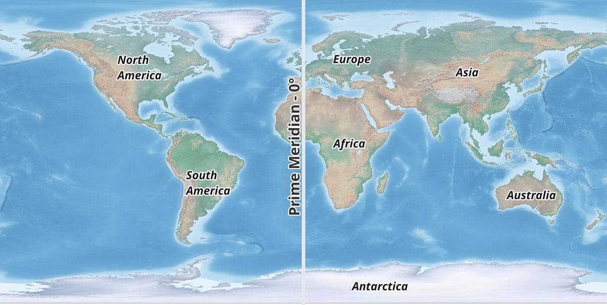
Longitude lines, or meridians, are imaginary vertical lines that run from the North Pole to the South Pole. They measure the distance east or west of the prime meridian, which is set at 0° longitude and passes through Greenwich, England. Unlike latitude lines, which are parallel, longitude lines converge at the poles.
What is at zero degrees latitude?
Zero degrees latitude is the line designating the Equator and divides the Earth into two equal hemispheres (north and south). The equator is the longest line of latitude, encircling the Earth horizontally at an equal distance from the North and South Poles. It measures approximately 40,075 kilometers (24,901 miles) in circumference.

What is at zero degrees longitude?
Zero degrees longitude is an imaginary line known as the Prime Meridian. The Prime Meridian is the starting point for measuring longitude and is set at 0° longitude. This line runs through Greenwich, a borough of London, England, and it is the basis for the world’s time zone system.
Zero degrees latitude and zero degrees longitude is a degree confluence
Where the Earth’s zero degrees latitude (the Equator) and zero degrees longitude (the Prime Meridian) cross each other (0°N 0°E), is known as a degree confluence.
What is a degree confluence?
A degree confluence refers to a point on the Earth’s surface where the latitude and longitude lines intersect at whole-number degrees. For example, the point where 45°N latitude intersects 90°W longitude is a degree confluence.

If you look at the intersection of 0 degrees latitude (known as the equator) and 0 degrees longitude (known as the prime meridian) on a map, you will see that the degree confluence falls in the middle of the Atlantic Ocean, in the Gulf of Guinea off the coast of western Africa.
The closest country to 0°, 0° is the African country of Ghana which lies about 614 km (382 mi) to the north of this confluence.
The closest piece of land to 0°, 0° is a small islet offshore of Ghana, between Akwidaa and Dixcove at the latitude and longitude coordinates of 4°45′30″N, 1°58′33″W. The distance from this islet to 0°, 0° is about 570 km (354.2 mi).

Zero degrees latitude and zero degrees longitude is marked by an ocean buoy
The open ocean lies at zero degrees latitude and zero degrees longitude.
This coordinate is marked by a weather observation buoy (Station 13010—Soul), placed there as part of the Prediction and Research Moored Array in the Atlantic, also known as PIRATA and is operated by the countries of United States, France, and Brazil.

Null Island
There is a fictional island known as Null Island attributed to the degree confluence of zero latitude and zero longitude. “Null Island” is a term used humorously by geographers and cartographers. Despite the name, it is not an actual island but a conceptual placeholder for data points that lack proper coordinates.
Although it’s not clear when the concept of Null Island was conceived, it came to prominence with the release of public domain Natural Earth GIS data. This one square meter area island is used for troubleshooting purposes for flagging geocoding failures, which is geographic data that cannot be properly located due to an error.
When a GIS software program or other mapping tools are unable to properly assign geographic coordinates to an address, the address record might be assigned a coordinate of 0,0 so cartographers can flag those address with errors.
Learn more: Null Island: Where Geocoding Errors Go to Live.
This article was first published on September 17, 2015 and has since been updated.