
Updated 2018 NAIP imagery is being made available on a state by state basis. California imagery was recently made available. So far this year, 2018 aerial imagery covering 20 states has been added to the USDA’s direct access site for NAIP imagery.
NAIP stands for National Agriculture Imagery Program and it is a part of a series of products that the USDA offers. NAIP aerial imagery is acquired on a three-year cycle during the agricultural growing season across the continental United States.
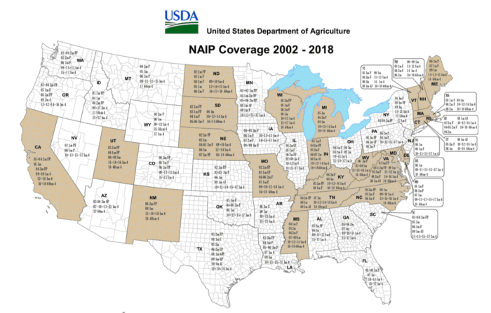
This NAIP Coverage map shows aerial acquisitions by state from 2002 to 2018. Each state lists the years of flight, image resolution, and format.
Visit: Direct Data / NAIP, USDA Geospatial Center Gateway
