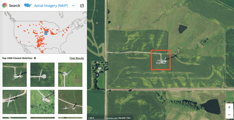
Descartes Labs recently unveiled its GeoVisual Search application which uses machine learning to visually search satellite imagery for similar geographic features. The platform is built on available satellite imagery: Landsat covering the world, National Agriculture Imagery Program (NAIP) covering the United States, and PlanetScope, covering China.
GeoVisual Search is another showcase of Descartes Lab’s Artificial Intelligence (AI) capabilities. The company also produces near real-time crop forecasts using machine learning. More recently, Descartes Labs unveiled high resolution mosaics of Landsat 8, Sentinel 1 and 2, and NAIP imagery.
GeoVisual provides rapid search results based on users selecting a sample area of a satellite imagery tile. Imagery is available at a range of resolution. The NAIP has the high resolution at 1 meter, Landsat 8 imagery is presented as a 15-meter global composite, and PlanetScope is sub-5-meters. The search function is pretty straightforward and is triggered by clicking on a small area on the chosen satellite imagery. Each satellite imagery source has been divided in 128 x 128 pixel dimension tiles. Each tile is then compared using machine intelligence against 512 possible features to match similar tiles.
For example, click on an image contains a wind turbine, and the application will return a list of thumbnails of similar areas as well as a plot of other matched locations across the United States.

For each satellite imagery product, there are sample searches for users to select to explore GeoVisual Search like this search result of snow capped mountains for Landsat 8:

Visit: GeoVisual Search
Descartes Labs offers an overview of the search application and the underlying imagery and technologies supporting it: GeoVisual Search: Using Computer Vision to Explore the Earth
