
artificial intelligence
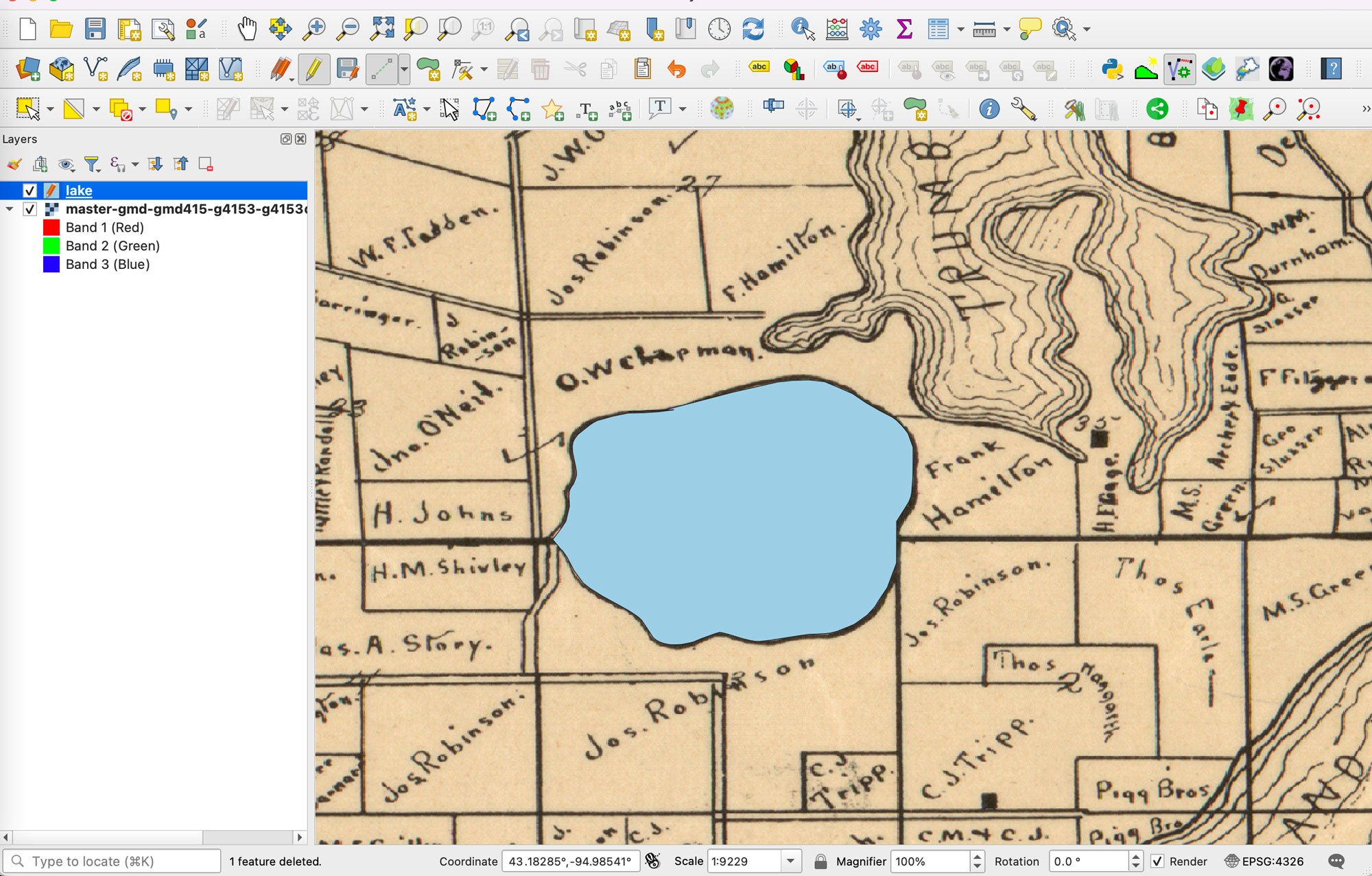
Using AI to Digitize Data From Scanned Maps
This AI-powered plugin is designed to automate the digitization of data from scanned maps and PDFs in QGIS for GIS users.
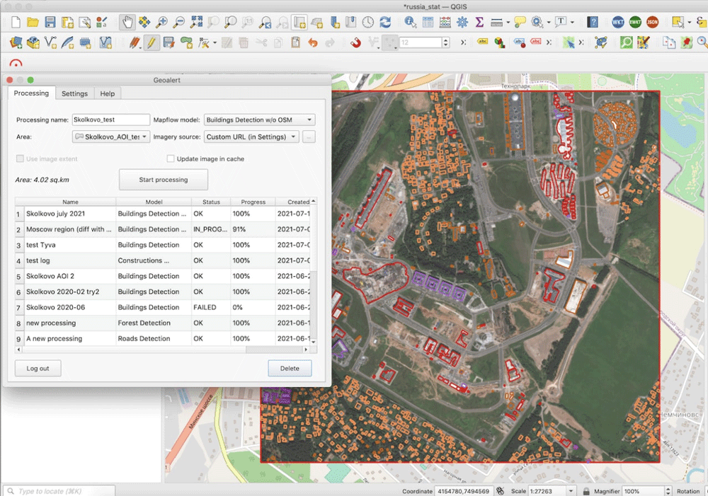
Run AI-Mapping in QGIS over high-resolution satellite imagery
Mapflow is a QGIS plugin that lets users extract real-world objects from satellite imagery.

Mapping Schools with Artificial Intelligence
Researchers are using AI to map schools in countries where many schools are undocumented so as to connect children with schools.

Converting Historical Maps to Satellite-Like Imagery
Old maps and images can now be converted to make them similar to our modern satellite-base views, giving stylized views a more realistic appearance.

The Important of Mapping Trees for Wildfire Management
The California Forest Observatory, created by Salo Sciences, has applied a new artificial intelligence tool that maps every tree in California.

Artificial Intelligence Was Used to Discover a New Nasca Line
Researchers tested out the use of artificial intelligence to assist with finding new Nasca lines.

Tracking Lost Dogs with Their Nose Prints
A new Chinese Artificial Intelligence startup called Magvii is working on new technology that could help reunite lost pets and their owners.

When AI Goes Wrong in Spatial Reasoning
Machines can learn ‘wrong’ or biased information, creating large problems and poor conclusions when it comes to spatial data.

Geospatial Artificial Intelligence: Emerging Trends and Challenges
There are both challenges and opportunities that Artificial Intelligence (AI) has in applying geospatial and GIS knowledge that also addresses issues of time and spatial bias.

Researchers are Using Machine Learning to Better Predict Weather Patterns
The enormous amount of data from Earth-observing satellites is pushing researchers to use machine learning to mine the information and improve climate models.

Using Visual Search to Find Geographically Similar Features on Satellite Imagery
Descartes Labs recently unveiled its GeoVisual Search application which uses machine learning to visually search satellite imagery for similar geographic features.

GIS and Innovations in Machine Learning
Machine learning or artificial techniques has been rapidly transforming many areas related to GIS and spatial applications

Google’s PlaNet: Geolocating Photos Using Artificial Intelligence
Google and researchers at the RheinischWestfälische Technische Hochschule Aachen University have developed an artificial intelligence system capable of identifying locations more consistently accurately than a human is able to do.

GIS and Artificial Intelligence Used to Build Facebook’s World Population Map
Facebook has used a combination of existing GIS data, high resolution imagery, and artificial intelligence to develop a detailed population map of the world.

Orbital Insight Shows How Artificial Intelligence (AI) Can Be Used to Study Images from Space
Orbital Insights has developed a “deep learning” processes which uses artificial intelligence to pull data from satellite imagery.