
GIS and Geospatial Technologies
Articles focusing on the application of geographic information systems (GIS), geospatial technologies, remote sensing, LiDAR, and Global Positioning System (GPS). These technologies serve as critical tools for understanding and interacting with our physical environment. GIS allows for the mapping and analysis of spatial data Geospatial technologies refer to the various tools used to measure and analyze Earth’s lands and resources. Remote sensing provides a way to collect data from a distance, often via satellites or high-flying aircraft, and is commonly used for environmental monitoring and military applications.
GIS subcategories :
GIS Career | GIS Data | GIS Industry | GIS Learning | GIS Software | GPS | Remote Sensing | Spatial Analysis

X is Longitude, Y is Latitude
Why is X longitude and Y latitude in GIS? Understand how geographic coordinates work and discover simple ways to remember the difference.

How to Create a Radial Flow Map Using QGIS
Learn how to create a radial flow map in QGIS using U.S. Census migration data with this step-by-step GIS tutorial.
Introduction to GIS
GIS is a technological field that incorporates geographical features with tabular data in order to map, analyze, and assess real-world problems.
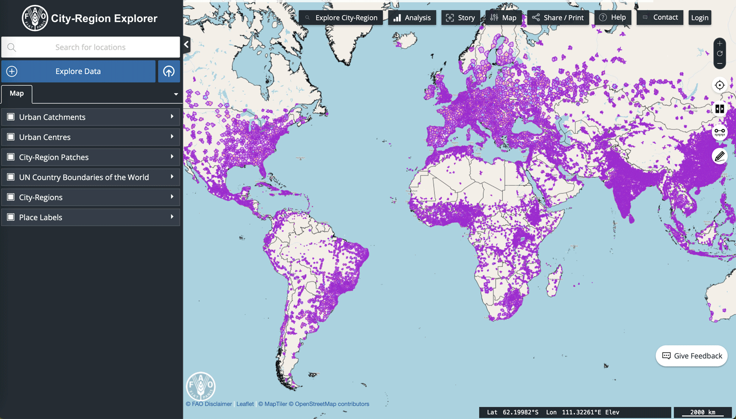
How the FAO’s City-Region Explorer Maps Urban Connections
Explore the FAO's City-Region Explorer to see how GIS maps connections between cities and surrounding communities.
Geography and GIS Glossary
This Geography and GIS glossary provides definitions for terms related to geographic information systems (GIS), cartography, remote sensing, and other ...

Where are GIS Professors Hired From?
Researchers analyzed GIS faculty hiring data to identify geographic patterns influencing job placement.

Shapefile Viewers
Explore viewers for visualizing GIS vector data in shapefile format, available for both desktop and web browsers.
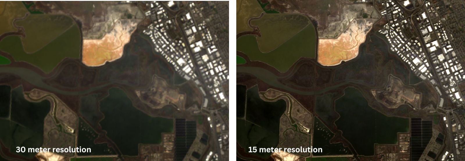
Pan Sharpen Landsat Imagery in QGIS
This QGIS tutorial guides you through pan sharpening Landsat imagery by combining the 15-meter panchromatic band with lower-resolution multispectral bands.

Pan Sharpening in GIS
Enhance spatial detail in multispectral images with pan sharpening. Learn how this GIS technique combines data for sharper, more detailed satellite imagery.

Overview Effect: Quotes from Astronauts After Seeing the Earth from Space
The Overview Effect is a shift in awareness by astronauts seeing Earth from outer space as a “tiny, fragile ball of life.”
How to Find the URL to an ArcGIS Online Web Map and Add it to QGIS
Learn how to find URLs for older feature and map servers hosted on ArcGIS Online so they can be added to QGIS.

How to Use Esri File Geodatabases in QGIS
Learn how to load both Esri vector and raster file geodatabases in QGIS.

Little Known QGIS Parlor Tricks
The coordinate box in QGIS is one place where you can uncover neat little GIS mapping tricks.
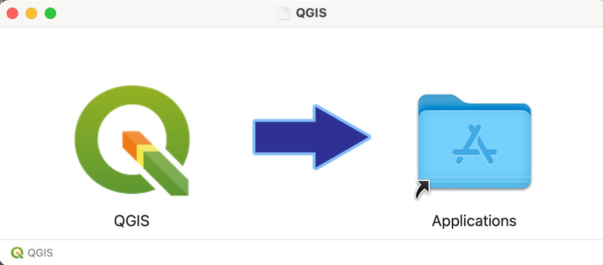
How to Install QGIS on a Mac Computer
Follow these step-by-step instructions on how to install QGIS on a Mac.

Witness Posts
Witness posts are signs that alert visitors to the presence of a nearby survey marker.

Types of GIS Data Explored: Vector and Raster
Explore the key differences between GIS vector and raster data, and how each type supports diverse spatial analysis tasks.

Building a GIS Career
Geospatial technology is widely used across industries, with evolving GIS skills. Here are tips to prepare for a GIS career.

5 Ways GIS Users Can Broaden Their Geospatial Skills
From programming and remote sensing to volunteering and networking, there are many ways to build new geospatial skills.
Learning GIS Programming
Having some competence in programming has become a critical requirement for many geospatial positions. So which languages should you learn for GIS programming?

Choosing the Right Satellite Bands for Remote Sensing
Learn how different satellite sensors respond to Earth's features and which spectral bands are best for remote sensing.

Adapting Time Series Data for Earth Observation
UniTS is a tool designed to simplify the process of using multiple time series datasets created over different time periods and for different geographic resolutions.

Relief Inversion
Telling the difference between a canyon and a mountain on aerial or satellite imagery can sometimes be tricky due to an optical illusion known as relief inversion.

Collecting GIS Data in the Field Using QGIS and QField
This QGIS tutorial takes you through the steps to synchronize a map project with QField in order to collect GIS data using a mobile device.
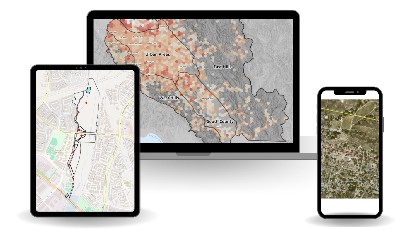
Using QGIS to Create a Hexbin Map
It is fairly easy to create a hexbin map using QGIS by following this GIS tutorial.

Before There was GPS: Personal Navigation in the Early 20th Century
Here are a few creative ways inventors tried to make driving directions easier before there was GPS.
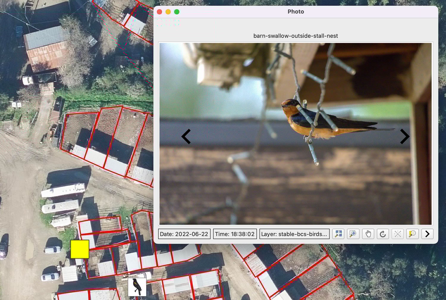
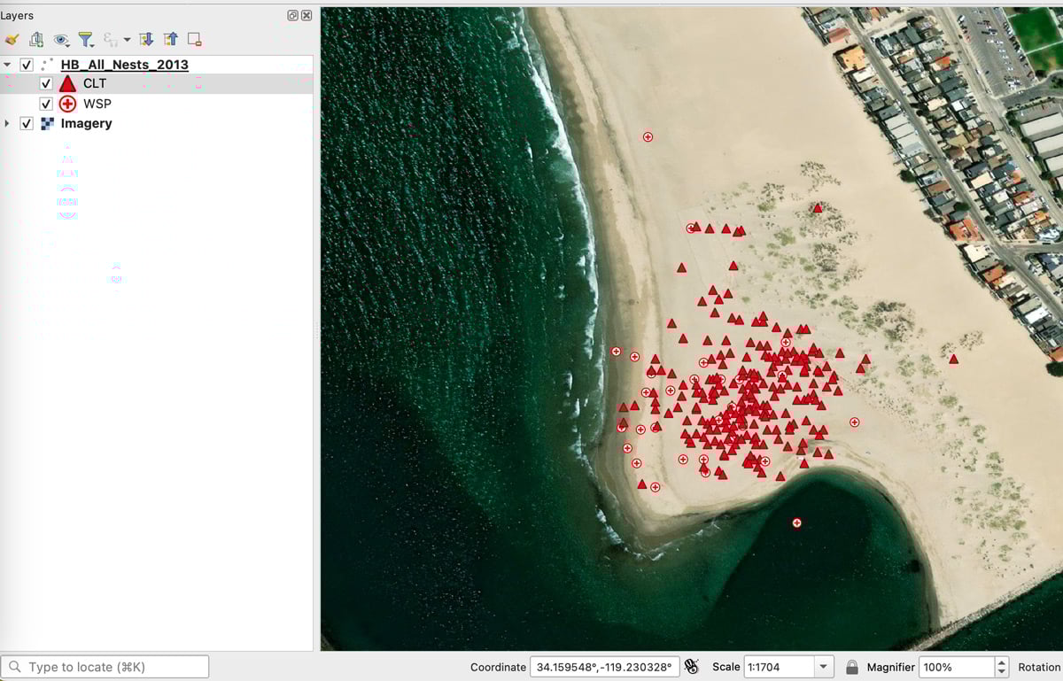
Mapping Geotagged Photos in QGIS
Geotagged photos can be easily mapped out in QGIS by following this GIS tutorial.