
GIS and Geospatial Technologies
Articles focusing on the application of geographic information systems (GIS), geospatial technologies, remote sensing, LiDAR, and Global Positioning System (GPS). These technologies serve as critical tools for understanding and interacting with our physical environment. GIS allows for the mapping and analysis of spatial data Geospatial technologies refer to the various tools used to measure and analyze Earth’s lands and resources. Remote sensing provides a way to collect data from a distance, often via satellites or high-flying aircraft, and is commonly used for environmental monitoring and military applications.
GIS subcategories :
GIS Career | GIS Data | GIS Industry | GIS Learning | GIS Software | GPS | Remote Sensing | Spatial Analysis

The Geography Network
Esri launched the Geography Network as a collaborative system for sharing digital geographic information on the internet.

Introducing the ArcGIS Platform: One Look, Many Applications
Perhaps the most immediate impact for users leaving the 2000 ESRI User Conference is the announcement of the unification of the ESRI product line, called ArcGIS.
How to Add a Custom Symbol to Arcview 3x
This article will show you in easy to follow steps how to add your own image file to ArcView 3x in order to create a custom symbol.
Realizing the Benefits of an N-Tiered Enterprise GIS
This year's conference is an especially significant event in the history of the GIS industry because of several concurrent developments in technology.
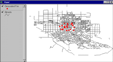
Geocoding Primer
This tutorial explains how to geocode using Esri's ArcView 3.x GIS software.

Thirty Tips and Tricks for Programming in Avenue
Some tips and tricks for customizing ArcView 3x using Avenue
Number of Year 2000 Fortune 1000 Companies by State
Number of Fortune 1000 companies categorized by state for the year 2000. The list of total count of Fortune 1000 ...
Fortune 1000 Companies By State for the Year 2000
Listed below are the Fortune 1000 companies listed by state for the year 2000. Each records lists the company name, ...

U.S. discontinues selective availability of GPS to public
On May 1, 2000, the U.S. government discontinued "selective availability", which was the intentional degradation of GPS signals.
How to Change Default Directories in ArcView 3x
After using ArcView 3x you’ve probably noticed the directory defaults. You can easily change the default temp directory, the first directory ...
GIS Day: A Celebration
On November 19, 1999 thousands of businesses, governments and schools participated in GIS Day. Coming on the tail end of ...
How to Run an Excel Macro in ArcView 3x
Using Avenue, you can easily run Excel Macros from within ArcView. Difficulty Level: Average Time Required: 10 minutes Here’s ...

GIS Software Components: Examples Using OpenMap and MapObjects
The ultimate goal of software components is to fuse the use of different pieces of software into one smoothly operating package.
How to Select Ridgelines From a DEM Using Spatial Analyst
Selecting out ridgelines from a DEM using ArcView 3x’s Spatial Analyst extension is pretty straightforward. These steps assume the initial ...

What is Open GIS?
Open GIS is the full integration of geospatial data into mainstream information technology.

Mapping the Earth – the Shuttle Radar Topography Mission
Space Shuttle Endeavour lifted off on February 11, 2000 and one of its missions is an ambitious mapping of the earth.

How to Convert .e00 Files to Coverages With ArcView 3x
To convert .e00 import files to coverages on a Windows operating system with ArcView installed, follow these instructions.