
machine learning

How Remote Sensing and GIS Are Improving Wildfire Forecasting
Advances in GIS, satellite imagery, and AI are helping scientists forecast where wildfires are most likely to ignite, spread, and produce hazardous smoke.

Reliability of Machine Learning Maps
Academics are increasingly adopting machine learning maps to better understand what can happen for a range of environmental events.
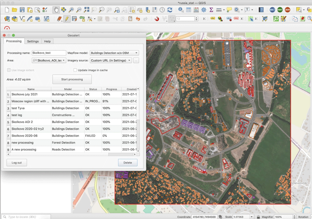
Run AI-Mapping in QGIS over high-resolution satellite imagery
Mapflow is a QGIS plugin that lets users extract real-world objects from satellite imagery.

Mapping Trees in West Africa
Researchers used high resolution satellite imagery and machine learning to map trees in West Africa.

Mapping Schools with Artificial Intelligence
Researchers are using AI to map schools in countries where many schools are undocumented so as to connect children with schools.

Machine Learning and Object Detection in Spatial Analysis
Picterra offers a relatively easy to use interface that allows users train AI on satellite and aerial imagery to detect features.
Open Repository for Geospatial Training Data Released
Radiant Earth has launched Radiant MLHub, a cloud-based open library for training geospatial data used by machine learning algorithms.

Using Machine Learning and Surface Deformation Data to Predict Earthquakes
There is no easy solution for earthquake prediction, but machine learning in particular has made forecasting far better.

Optimizing Traffic with Autonomous Vehicles and Machine Learning
Improving traffic can be achieved by incorporating geospatial technology in autonomous cars, such as sensors and external information.

When AI Goes Wrong in Spatial Reasoning
Machines can learn ‘wrong’ or biased information, creating large problems and poor conclusions when it comes to spatial data.

Using Machine Learning and Satellite Imagery for Street Address Generation
Facebook and MIT Labs researchers have developed a method employing machine learning and satellite images to create street addresses in regions lacking unique building addresses.

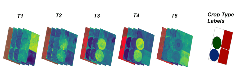
Mapping Tree Species in the Amazon Using Satellite Imagery and Machine Learning
Researchers have modeled tree species distribution in Peruvian lowland Amazonia using satellite imagery and machine learning techniques.

Detecting Storm Intensity from Satellite Imagery Using Machine Learning
The Deep Learning-based Hurricane Intensity Estimator is an experimental portal that uses machine learning techniques to analyze spatial patterns in infrared satellite imagery in order to predict tropical cyclone intensity.

Startups and the Future of Spatial Analysis
A growing number of startups are developing new approaches to advanced spatial analysis for everyday solutions across many fields and industries.

Creating Ground-level Views from Satellite Imagery
Recreating a ground-level image and perspective using satellite imagery has only recently been developed.

Future of Mobile Spatial Applications and Image Recognition
Image recognition software and algorithm development is likely to be increasingly applied with spatial applications.
Using Machine Learning to Speed Up Electrical Grid Mapping
Development Seed, working for the World Bank Group, created a methodology for integrating machine learning with manual mapping in order to speed up the mapping of high-voltage (HV) grids in developing countries.

The Role of GIS in Predicting Road Conditions
Recent developments in GIS and analytical applications have demonstrated that predicting road conditions, and thus preventing traffic accidents and possibly even traffic in the first place, is possible.

Transforming Satellite Imagery Classification with Deep Learning
Deep learning has a potential to transform image classification and its use for the spatial sciences, including GIS.

Will 2017 be Remembered as a Stellar Time for Earth Observation?
Joe Francica, Managing Director Location Intelligence Solutions with Pitney Bowes discusses the growth and direction of Earth Observation satellites.

GIS and Machine Learning for Habitat Protection
With gains in computational power and accessibility to off the shelf models, often used in commercial or open source software, applying machine learning techniques with GIS has become far easier for conservation and habitat specialists.

Researchers are Using Machine Learning to Better Predict Weather Patterns
The enormous amount of data from Earth-observing satellites is pushing researchers to use machine learning to mine the information and improve climate models.

Using Visual Search to Find Geographically Similar Features on Satellite Imagery
Descartes Labs recently unveiled its GeoVisual Search application which uses machine learning to visually search satellite imagery for similar geographic features.

Using Machine Learning and Satellite Imagery to Estimate Corn Crop Production
Descartes Lab, a start-up organization, has created crop production analysis that uses millions of satellite images and machine learning to produce accurate data about the production of agricultural crops.

GIS and Innovations in Machine Learning
Machine learning or artificial techniques has been rapidly transforming many areas related to GIS and spatial applications
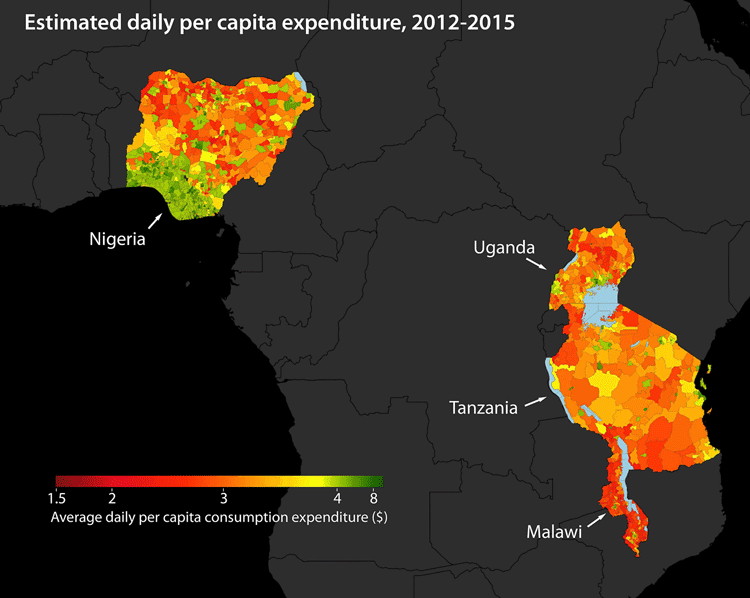
Using Machine Learning to Map Poverty from Satellite Imagery
Satellite images are now being used to map poverty levels around the world using machine learning used to analyze specific poverty data using a convolutional neural network.