
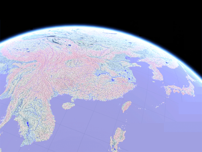
Scientists have developed MERIT Hydro, a new global map of river systems, with a resolution of 3‐arc sec (90 meters at the equator).
The high-resolution dataset was created with crowdsourced hydrography data from OpenStreetMap as well as water body data (G1WBM, Global Surface Water Occurrence). This data, coupled with MERIT DEM, was fed into an algorithm that extracted river networks by separating actual inland basins from false depressions caused by errors in the topographic data collected by spacecraft radar systems such as NASA’s Shuttle Radar Topography Mission.

The researchers pulled OpenStreetMap data tagged with water related subjects such as “waterway,” “river,” “stream,” “brook,” and “wadi.” This allowed the algorithm to identify small streams not detectable on Landsat imagery. It also enabled the researchers to flag man-made hydrological structures such as canals that might be prone to flooding.
Downloading MERIT Hydro
The hydrological dataset, in geoTIFF format, has been made freely available for research and education purposes and can be downloaded from http://hydro.iis.u‐tokyo.ac.jp/~yamadai/MERIT_Hydro/.
The Study
Yamazaki, D., Ikeshima, D., Sosa, J., Bates, P. D., Allen, G., & Pavelsky, T. (2019). MERIT Hydro: A high‐resolution global hydrography map based on latest topography datasets. Water Resources Research. https://doi.org/10.1029/2019WR024873
A More Accurate Global River Map, Eos, July 12, 2019