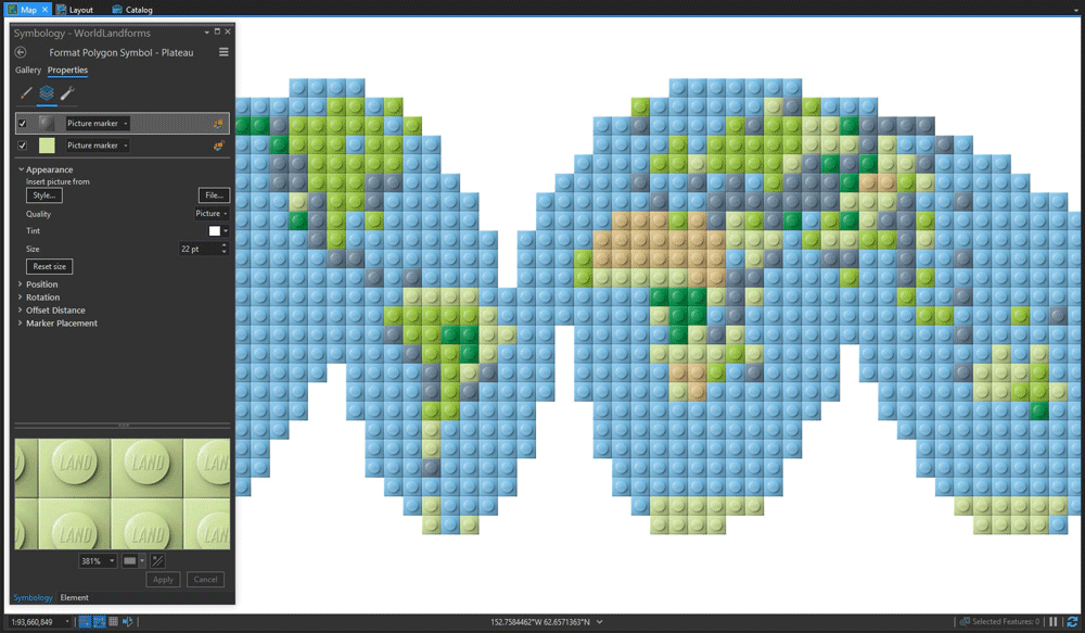
Depending on the GIS software you want to use, there are a few different ways to create a Lego-style map.
Create a Lego Map Using ArcGIS
John Nelson has a few write-ups outlining how to use ArcGIS products to replicate the look of lego tiles on a map. For those using ArcGIS Pro, Nelson has developed a Lego Map style.
Cartographers can use this style to simulate the look of Lego bricks complete with the studs on any vector point, line, or polygon layer.
Nelson describes his Lego map style and the creation process in his Esri blog post, “Steal this Lego Map Style for ArcGIS Pro, please.“
Create a Lego Map Using QGIS
Andriy Yaremenko has developed a step-by-step process for creating a lego style map entirely within QGIS. The entire process involves creating a grid layer which then has a centroid overlain on top to mimic the Lego brick studs.
Shadow styling added to the centroids polishes out the end product with 3D look.
More: How to create Lego Map Style in QGIS
Brickify a Map Image
There are solutions available that let you manipulate an existing map image after the map to replicate the Lego look. Dan Harris from the Cairngorms National Park Authority outlined for the Ordnance Survey how he used QGIS, the Windows OS app Brickaizer, and Stud.io to create a 3D Lego map of Scotland.
More: Lego Cartography – Ordnance Survey

John Nelson and Vanni Zhang created a fun little online Brick-ifer app that takes your choice of an Esri vector or satellite basemap and turns it into a Lego style clip.
More: Brick-ifer

Make a Map out of Actual Lego Bricks
If you want to make a physical map out of actual Lego bricks, then Richard Süselbeck from HERE has a writeup explaining how he used different colors to build a topo style map with Lego bricks.
More: Build your own map with LEGO


