
QGIS
QGIS (formerly known as Quantum GIS) is a popular open source GIS software application. QGIS can be downloaded for free.
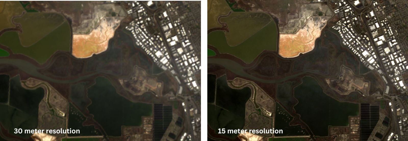
Pan Sharpen Landsat Imagery in QGIS
This QGIS tutorial guides you through pan sharpening Landsat imagery by combining the 15-meter panchromatic band with lower-resolution multispectral bands.
How to Find the URL to an ArcGIS Online Web Map and Add it to QGIS
Learn how to find URLs for older feature and map servers hosted on ArcGIS Online so they can be added to QGIS.

How to Use Esri File Geodatabases in QGIS
Learn how to load both Esri vector and raster file geodatabases in QGIS.

Little Known QGIS Parlor Tricks
The coordinate box in QGIS is one place where you can uncover neat little GIS mapping tricks.
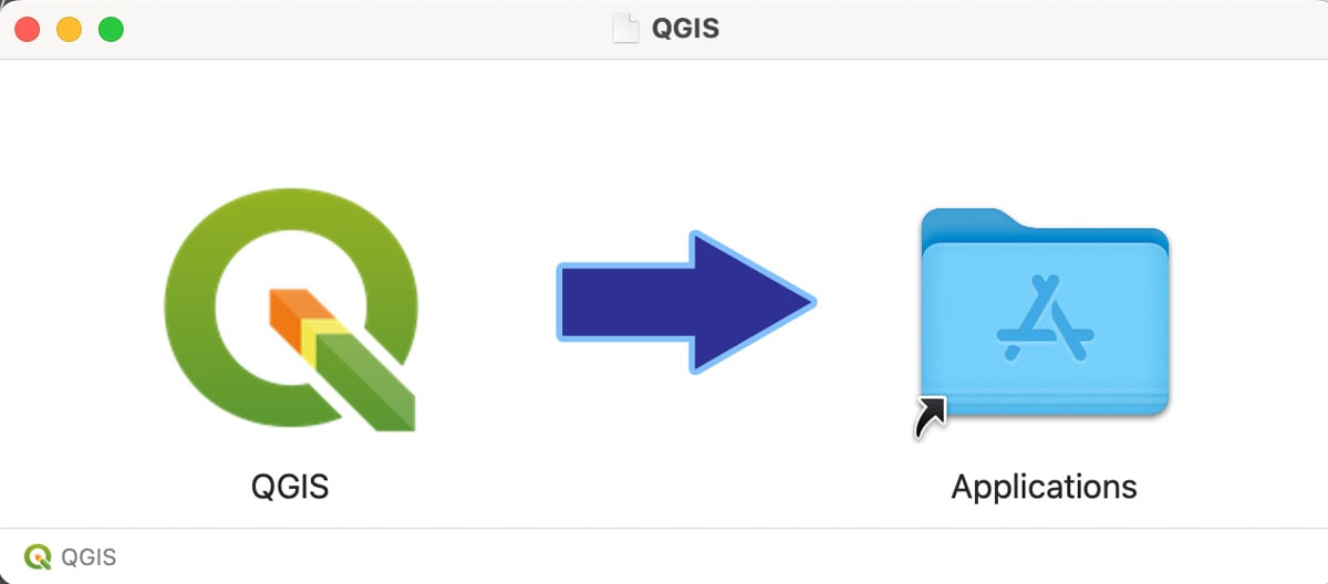
How to Install QGIS on a Mac Computer
Follow these step-by-step instructions on how to install QGIS on a Mac.

Collecting GIS Data in the Field Using QGIS and QField
This QGIS tutorial takes you through the steps to synchronize a map project with QField in order to collect GIS data using a mobile device.

Five Reasons to Start Using QGIS
Here are five compelling reasons to start using the open-source GIS platform QGIS, a free and open source software.
Free Ways to Learn QGIS
If you want to start learning how to use QGIS, a free and open source GIS software package, there are some excellent free resources out there.

Open Source GIS and Freeware GIS Applications
There are many open source GIS and web mapping applications to choose from.

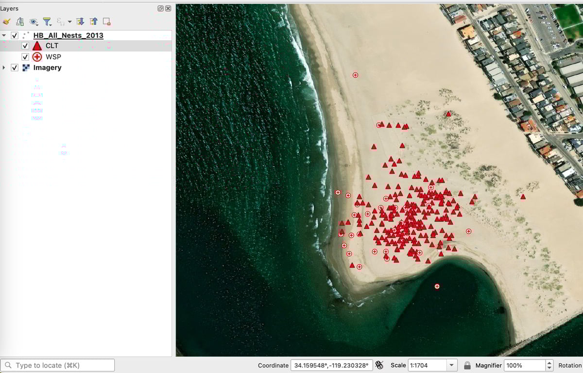
Finding GIS Data and Using QGIS to Map Caves
Dackery Geiman outlines the challenges he encountered finding geospatial data about caves and using QGIS to map cave density in Missouri.

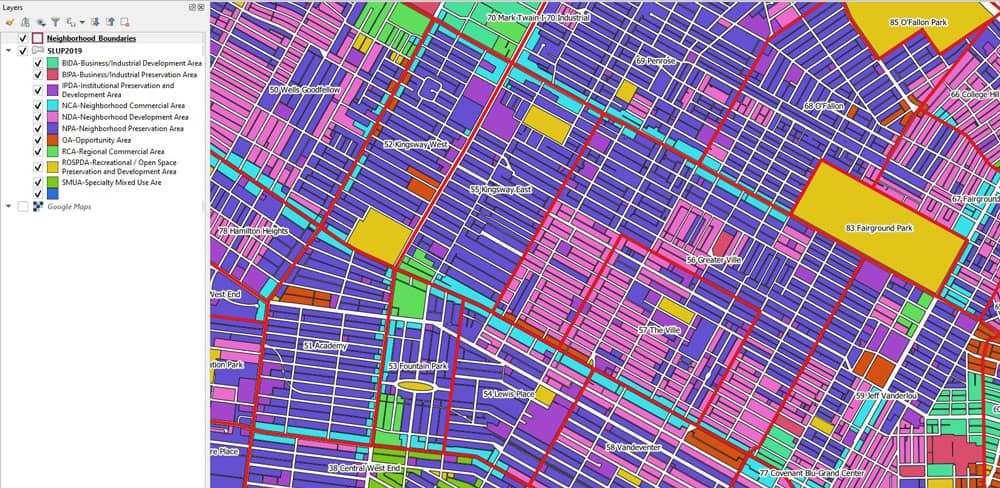
GIS in Land Use Planning and Surveying
Michael Parks explains how he used GIS data and imagery to develop geospatial analysis and maps to recommend potential base camp sites.

Using GIS to Map Fly Fishing Destinations
William Bakemeyer describes how he used QGIS and open source data to create a fly fishing map.

QGIS from a Graduate Student’s Perspective
Kent Campbell writes about how he has come to view the benefits of using QGIS as a graduate student.

How to Add Data from ArcGIS Online to QGIS
Adding data from an ArGIS Online Map Service or Feature Service into a QGIS map project is fairly easy and quick in most instances.
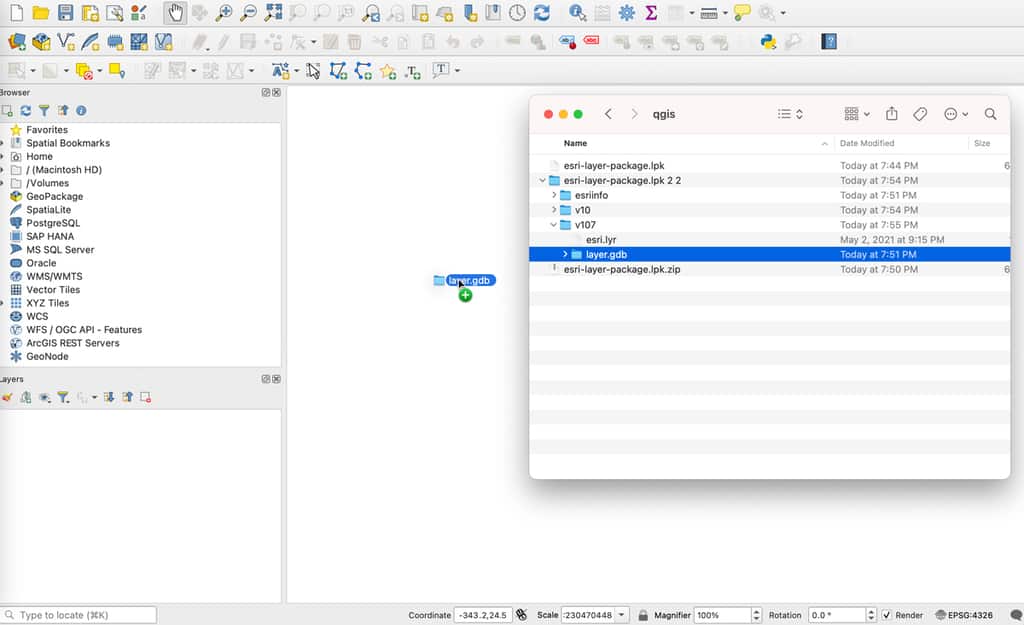
How to Import an Esri Layer Package in QGIS
While QGIS cannot directly read an Esri layer package, there is a simple technique to unpack the file and import it into this GIS software.

How to Create Firefly Cartography with QGIS
Firefly cartography is a cartographic style used to create maps that glow. Learn how to make a firefly map using QGIS.
Calculating Land Use Mix with GIS
Alexandros Voukenas explains how to calculate land use mix indices (such as entropy) in a GIS environment.
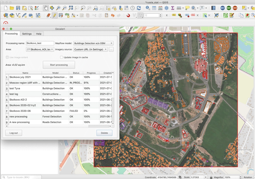
Run AI-Mapping in QGIS over high-resolution satellite imagery
Mapflow is a QGIS plugin that lets users extract real-world objects from satellite imagery.
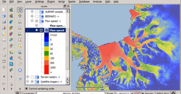
Quantarctica – Free GIS Data for QGIS
Quantarctica is a collection of freely downloadable GIS data for Antartica.

Businesses Using Open Source GIS
Businesses are using open source GIS software, finding that there are a lot of benefits along the way.
WebGIS Section 2: Overview of Tools and Technologies For WebGIS
This article introduces you to some of the open-source tools used in WebGIS.

QGIS Style Sharing Repository
A new tool has been deployed that lets QGIS users share style files.

Self-Guided QGIS Courses
These six QGIS courses are available for free self-guided learning.

QGIS and Free Mobile Applications
The capabilities of QGIS can be extended with plugins and mobile GIS apps.

How to Add Leader Lines to Labels in QGIS
The release of QGIS version 3.10 brought with it the native capability to add leader lines to labels.

24 Days of QGIS Tips
Using the #24daysofqgis hashtag, North Road, a geospatial company based out of Australia, will be tweeting out a QGIS tip or trick for 24 days starting on December 1.