
QGIS
QGIS (formerly known as Quantum GIS) is a popular open source GIS software application. QGIS can be downloaded for free.

Adding Real-Time Weather Data from OpenWeatherMap: QGIS Python Programming CookBook
Learn how to add real-time weather data from OpenWeatherMap in QGIS using Python from this section as part of this preview chapter, Creating Dynamic Maps from QGIS Python Programming CookBook.

Bing Aerial Image Service: QGIS Python Programming CookBook
Learn how to use the Bing Aerial Image Service in QGIS using Python from this section as part of this preview chapter, Creating Dynamic Maps from QGIS Python Programming CookBook.
Using the OpenStreetMap Service: QGIS Python Programming CookBook
Learn how to use the OpenStreetMap Service in QGIS using Python from this section as part of this preview chapter, Creating Dynamic Maps from QGIS Python Programming CookBook.

Layer Symbols: QGIS Python Programming CookBook
Learn how to symbolize layers using SVG and pie charts in QGIS using Python from this section as part of this preview chapter, Creating Dynamic Maps from QGIS Python Programming CookBook.
Scale and Layer Visibility: QGIS Python Programming Cookbook
Learn how to set up scale-dependent layer visibility in QGIS using programming from this section as part of this preview chapter, Creating Dynamic Maps from QGIS Python Programming CookBook.
Map Bookmarks: QGIS Python Programming CookBook
Learn how to create and navigate to map bookmarks using python in QGIS as part of this preview chapter, Creating Dynamic Maps from QGIS Python Programming CookBook.

Symbolizing Vector and Raster Layers: QGIS Python Programming CookBook
Learn how to symbolize vector and raster layers in QGIS using programming from this section of the preview chapter, Creating Dynamic Maps from QGIS Python Programming CookBook.
Accessing the Map Canvas, Changing Map Units, and Iterating over Layers
Learn how how to control an object through the Map Canvas, change map units, and how to loop through map layers in QGIS using Python. From: Creating Dynamic Maps from QGIS Python Programming CookBook takes a look at

Working with Coordinate Reference Systems: Mastering QGIS
This section of the free chapter preview of Mastering QGIS looks at working with coordinate systems in QGIS. Mastering QGIS is designed to bring users who want ...

Styling Vector and Raster Data: Mastering QGIS
This section of the free chapter preview of Mastering QGIS looks at styling vector and raster GIS data in QGIS. Mastering QGIS is designed to bring ...

Adding Functionality with Plugins: Mastering QGIS
This section of the free chapter preview of Mastering QGIS looks at using plugins to extend the functionality of QGIS. Mastering QGIS is designed to bring ...

Composing Maps: Mastering QGIS
This section of the free chapter preview of Mastering QGIS looks at making maps in QGIS. Mastering QGIS is designed to bring users who want to go ...

Working with Tables: Mastering QGIS
This section of the free chapter preview of Mastering QGIS looks at working with tables in QGIS. Mastering QGIS is designed to bring users who want ...
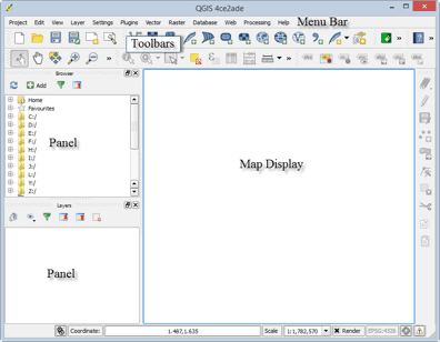
Tour of QGIS: Mastering QGIS
This section of the free chapter preview of Mastering QGIS covers the graphical user interface components of both QGIS Desktop and QGIS Browser. Mastering QGIS is ...
QGIS Download and Installation: Mastering QGIS
This section of the free chapter preview of Mastering QGIS covers downloading and installing QGIS. Mastering QGIS is designed to bring users ...

Generalization in GIS
Generalization is the method used in GIS to reduce detail in data. Learn about how to generalize GIS data using QGIS, ArcGIS, and other software tools.

Binning in GIS
Binning in GIS helps group data into categories, making it easier to see patterns and densities on maps.

Anita Graser | Profiles from the Geospatial Community
Anita Graser, a prominent figure in open source GIS, authored "Learning QGIS 2.0". She shares insights on her GIS journey and the future trends in open source GIS.
QGIS 2.0 Released
A new release of QGIS, the popular open source GIS software has officially been released. Each version receives a name ...

QGIS: Introducing the Quantum GIS Ecosystem
Anita Graser provides an introduction to the desktop, web, and mobile capabilities of the open source GIS software, QGIS in this guest article.
Getting Started With QGIS: Open Source GIS
Quantum GIS is an open source GIS desktop software more popularly known as QGIS. QGIS 1.0 was first released in ...

GIS on the Mac
One of the most popular options for running GIS software directly within the Macintosh OS environment is QGIS.
How to Go from GIS Novice to Pro without Spending a Dime
I have only taken one formal course in GIS; however, I consider myself a confident practitioner of the software and ...