
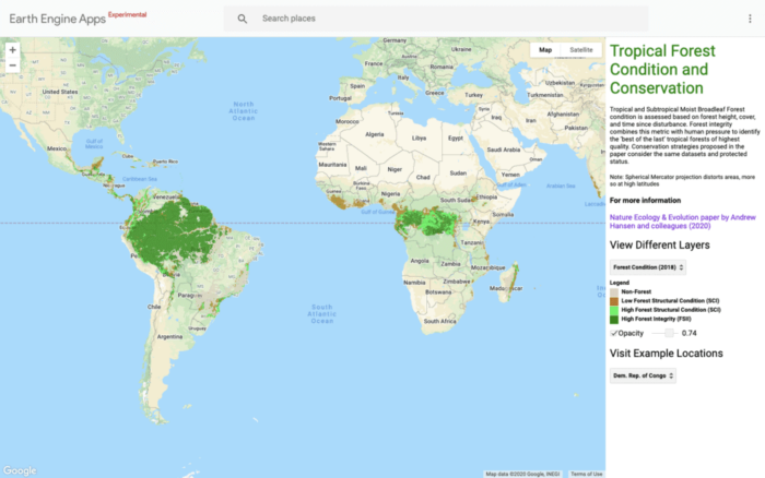
Researchers have created high resolution maps of tropical forest quality using remotely sensed data from NASA satellites.
A study analyzing the results of the mapped tropical forest quality was recently published in the journal Nature Ecology & Evolution. Researchers found that while about half of the world’s humid tropical trees (mostly located in the Amazon and Congo basins) can be considered “high quality” only 6.5% are under formal protections.
Tropical forests with high forest structural integrity are better able to support biodiversity, store carbon, mediate water yield, and provide other benefits for both wildlife and humans. By using data from NASA’s ICESat-2 and LANDSAT satellites, researcher were able to map out the degree of ecological quality among the tropical forests.

Information such as the height of vegetation, tree canopy thickness, and whether an area had been logged or burned were used to categorized the world’s tropical forest into degress of ecological quality .
The results of the analysis can be viewed via an interactive Google Engine map (Earth Engine: Tropical Forest Condition and Conservation) and more detail about how the maps were created can be found in the journal articles referenced below.

More
Hansen, A., Barnett, K., Jantz, P., Phillips, L., Goetz, S. J., Hansen, M., … & Rodríguez-Buritica, S. (2019). Global humid tropics forest structural condition and forest structural integrity maps. Scientific Data, 6(1), 1-12. https://doi.org/10.1038/s41597-019-0214-3
Hansen, A. J., Burns, P., Ervin, J., Goetz, S. J., Hansen, M., Venter, O., … & Pillay, R. (2020). A policy-driven framework for conserving the best of Earth’s remaining moist tropical forests. Nature Ecology & Evolution, 1-8. https://doi.org/10.1038/s41559-020-1274-7
Keck, A. (2020, August 25). Pinpointing high quality tropical forests. NASA. https://climate.nasa.gov/news/3013/pinpointing-tropical-forests-with-high-ecological-quality/#:~:text=High%2Dresolution%20NASA%20satellite%20data,the%20size%20of%20a%20forest.