
A team of researchers analyzed Landsat images over a 38-year period and found that a significant number of large U.S. rivers are changing colors.
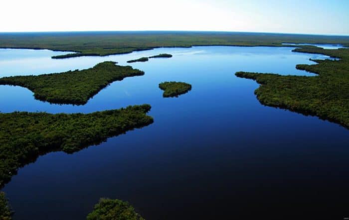
Why Does Water Look Blue?
Water by itself takes on a blue hue because water absorbs more color from long wavelength light (reds, oranges, and yellows) than it does from short wavelength light (blues). As white light enters the ocean, only the blue spectrum is reflected, making the water look blue.

What Affects the Color of Water?
Different river conditions affect what color the water will look. Algae growth, sediment, minerals, and other particles will affect what light is absorbed by the water, making it look green, yellow, red, or other colors.

How US Rivers are Changing Colors
With a study published in Geophysical Research Letters, researchers were able to analyze the changing color of major rivers in the contiguous United States over time by calculating surface reflectance from 234,727 Landsat images from 1984 and 2018 covering 108,000 kilometers of rivers. Rivers that were wider than 60 meters were included in this study.
The authors found three main conclusions from their study. Overall, there are broad regional patterns with river colors. 56% of major rivers are predominately yellow and other 38% were predominately green.
The researchers also found that river colors shift seasonally. Changes such as snowmelt, rainfall, agricultural practices can affect the color of rivers.
Lastly, the researchers calculated that one‐third of rivers had significant color shifts over the last 35 years.

Map of US River Colors
The resulting database of U.S. river colors, RiverSR, is available for viewing with this interactive map that visualizes the color of rivers across the USA. To get started, scroll down to the bottom of the overlay page and click the “go” button.
There are three data options that can be selected from the drop down menu: modal color (which maps the dominate color of every river), trends (which maps how each river’s color is trending over time), and seasonality (which maps how colors changing with the seasons).

The Study
Gardner, J. R., Yang, X., Topp, S. N., Ross, M. R., Altenau, E. H., & Pavelsky, T. M. (2020). The Color of Rivers. Geophysical Research Letters, e2020GL088946. https://doi.org/10.1029/2020GL088946