
GIS Data

Types of GIS Data Explored: Vector and Raster
Explore the key differences between GIS vector and raster data, and how each type supports diverse spatial analysis tasks.

X is Longitude, Y is Latitude
Here are some simple strategies for remembering that X is longitude and Y is latitude in GIS.

A Guide to Understanding Map Scale in Cartography
Map scale refers to the ratio between the distance on a map and the corresponding distance on the Earth's surface.

Overview of Elevation Data
This article reviews some of terminology and types of elevation based datasets available to GIS.

GIS 101: Learn About GIS
This GIS 101 page is the launch page for accessing information about GIS and geospatial technologies on GIS Lounge.

GIS Data: A Look at Accuracy, Precision, and Types of Errors
What are the types of error found in GIS data? This article reviews the difference between accuracy and precision and explains the most common types of error found in GIS data.
GDAL: Geospatial Data Abstraction Library
The Geospatial Data Abstraction Library (GDAL) is a set of software tools used by GIS platforms such as ArcGIS, QGIS, and GRASS GIS.

Ten Reasons Why Spatial Data Quality Matters More Now Than Ever
Geographer Josephy Kerski writes about 10 key reasons why geospatial data quality matters.

Understanding and mapping ZIP Codes
Resources for accessing ZIP code data. Ben Fry has created zipdecode that shows the location of all the ZIP codes in the United States.

World Bank and Geospatial Data
The World Bank in August 2018 launched the Integrated Geospatial Information Framework, which is seen as a way for GIS data to be provided for governments, NGOs, and companies to make more informed decisions that not only benefit their economies but also enable sustainable development.

Free Urban Planning GIS Book and Exercises
An open access book focusing on the use of GIS in sustainable urban planning and management includes six chapters containing exercises and GIS data.

Free GIS Data Viewers
Free data viewers for a variety of GIS data formats. These viewers allow you to display geographic data as well as perform some basic GIS functions.

GIS File Formats
Listed here are some of the more common file formats along with associated file extension for GIS file types.

Digitizing Errors in GIS
Digitizing in GIS is the process of converting geographic data either from a hardcopy or a scanned image into vector GIS data by tracing the features. Explained in this article are the types of common digitizing errors found when creating geographic data within GIS.

Assessing a School’s Economic Background Using GIS
I do pro bono GIS work from time to time, and a recent contribution was towards a local school that ...
California Supreme Court Rules that GIS Data are Public Record
After a lengthy battle in the court system, California’s Supreme Court has finally ruled in favor of allowing public access to the government’s GIS data in Orange County. Back in 2007, the Sierra Club sued the county for the right to use its GIS data for environmental mapping projects. Orange County resisted, however, claiming that the digital maps did not fall under the Public Records Act.

FEMA Flood Map Challenges
FEMA has been constantly updating and maintaining its Flood Hazard Mapping Program in order to provide ongoing flood risk assessments.

Explore John Snow’s Cholera Map using GIS Data
John Snow's well known cholera map is often cited as one of the earliest known examples of using geographic inquiry to understand a health epidemic although his famous dot map was actually created after the cholera epidemic to show disease clusters.

Attribute Data Types for GIS
There are two components to GIS data: spatial information (coordinate and projection information for spatial features) and attribute data. Attribute ...
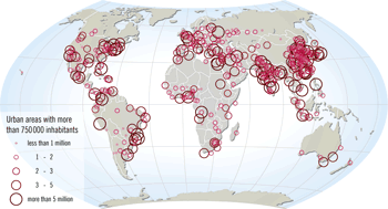
World GIS Data
Looking for global GIS data? Listed here are free sources for finding GIS data in both vector and raster formats ...

Where is the Phrase “80% of Data is Geographic” From?
Those that work in GIS data have probably heard the phrase "80% of data is geographic". What is the origins of this phrase, and is it true?
SDTS – GIS Data Standard
SDTS stands for Spatial Data Transfer Standard. SDTS was a standard for transferring earth-referenced spatial data across disparate computer programs. The U.S. ...

Data Capture in GIS
This article provides a brief overview of the GIS data collection process along with examples of methodologies for GIS data ...

Wind and GIS
GIS has many applications in wind mapping, analysis and modeling. Geographic data and modeling of wind performance can help site ...