
Much of the imagery presented in the news about Antarctica is taken from aerial and satellite imagery.
As a snow and ice covered continent, Antartica can look flat when viewed from space.
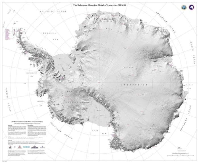
The Land of Snow and Ice
With an ice sheet covering all but about 0.04 percent of the continent [1], Antarctica is often referred to as the “the land of snow and ice”.
The continent holds 90% of the world’s ice (29 million cubic kilometers) and about 80% of its fresh water.
It’s that ice sheet, with an average thickness of 2.16 km that helps to make Antarctica the highest elevation continent on Earth.
Without the ice cover, Antarctica would rank as one of the lowest elevation continents on Earth [1]. The Byrd Subglacial Basin in western Antarctica, the lowest point on any of the Earth’s continental plates [2], lies 2,538 meters below sea level.
Antarctica’s Elevation

What is the Average Elevation of Antarctica?
The average elevation in Antarctica is 2,500 meters (8,200 feet). The South Pole is located at an elevation of 2,800 meters (9,300 feet).
What is the Highest Point in Antarctica?
The highest elevation in Antarctica is Mount Visson, with a peak of 4,892 meters (16,050 feet).
What is the Lowest Point in Antarctica?
The lowest point in Antarctica is Deep Lake, Vestfold Hills in East Antartica with a depth of -50 meters (−160 feet).
A closed lake, Deep Lake is hypersaline. This salinity keeps the lake liquid, even when the water temperatures drop to -20ºC [3].
References
[1] Ice sheets. (2011, May 13). Retrieved December 30, 2019, from http://www.antarctica.gov.au/about-antarctica/environment/sea-ice/ice-sheet
[2] Bedmap2 gives scientists a more detailed view of Antarctica’s landmass. (2013, March 8). Retrieved December 30, 2019, from https://phys.org/news/2013-03-bedmap2-scientists-view-antarctica-landmass.html
[3] Ivy, S. (2016, February 1). The cold case of Deep Lake. Lateral Magazine. Retrieved from http://www.lateralmag.com/articles/issue-7/the-cold-case-of-deep-lake