
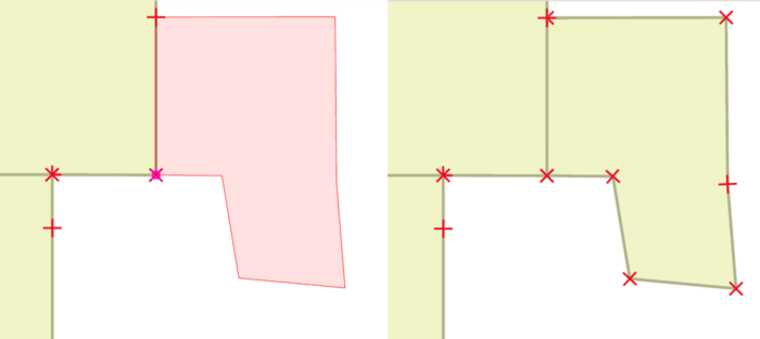
Snapping in GIS occurs during the editing of a GIS dataset. Snapping involves connecting a geometric vertex or edges of one feature to another. Snapping is an important setting when editing or creating GIS data because it ensures that edges and vertices that need to be adjoining are cleanly connected. Without snapping, errors in the data such as overlapping polygons, spaces between polygons, and overlapping lines can occur.

Setting up snapping in GIS involves setting a few parameters.

First, decide if vertices (or nodes), edges (or segments), or both need to be snapped. Next, the snapping tolerance needs to be set. This determines the distance away a vertex or segment needs to be to a neighboring feature in order to snap it. Setting this tolerance becomes important because you don’t want to accidentally snap features together that weren’t mean to be together because the snap tolerance was set to high. Conversely, a snap tolerance set too low runs the risk of not snapping features together that you need snapped.

How to Set up Snap Tolerance and Snap Options
Instructions on how to set up snap options while editing GIS data are specific to each GIS software. Directions can usually be found in the documentation section on editing. Here are a few quick links to the more common GIS software programs:
- QGIS: Setting the Snapping Tolerance
- ArcGIS Pro: Configuring Snapping
- ArcGIS for Desktop – ArcMap: About Snapping
- MapInfo: Changing Snap Tolerance