
Troy Lambert

Data Driven: GIS Guiding the Future
Troy Lambert
Mapping has always been data driven, and the more data we gather, the more important practical visualization of that data becomes.

Mapping Market Reach
Troy Lambert
Troy Lambert discusses how colleges can use GIS and mapping technology to better target marketing.

Using GIS During Fire Season
Troy Lambert
Every year, GIS users get better at assembling data and creating meaningful maps that help decision makers predict fires, set fire risk levels, and deploy assets in the most efficient manner possible.

GIS and Artificial Intelligence Used to Build Facebook’s World Population Map
Troy Lambert
Facebook has used a combination of existing GIS data, high resolution imagery, and artificial intelligence to develop a detailed population map of the world.
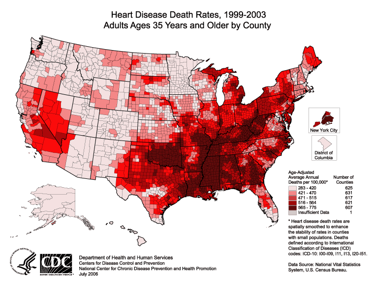
Where Have You Been? Using GIS to Analyze Residential History and Health Care
Troy Lambert
Troy Lambert takes a look at how the power of GIS can be leveraged to greatly influence healthcare as we know it.